A European Vacation

Ireland, Paris and London
Summer 2006
(2-24 August)
Version: Version 1.0
Date issued: 25 Sep 06
Author: Thomas @ travelogues.x10hosting.com
File Name: EuropeanVacationSummer2006.doc
A European Vacation
Ireland, Paris and London
Summer 2006
(2-24 August)
Version: Version 1.0
Date issued: 25 Sep 06
Author: Thomas @ travelogues.x10hosting.com
File Name: EuropeanVacationSummer2006.doc
|
Table of Contents
2.1 Getting There via Newcastle 2.3 Brú na Bóinne (Knowth and Newgrange) 2.5.1.2 Derry (a.k.a. Londonderry) 2.5.1.3 South to the Republic of Ireland 3.2.1 Place de la Concorde and Jardin des Tuileries 3.2.4 Arc de Triomphe at Night 3.3 Churches - Saint-Sulpice, Saint-Denis, Sacré Coeur, Notre Dame, Sainte-Chapelle 3.4 Musée d’Orsay, l’Orangerie, Centre Pompidou, Louvre, Cluny 4.1.2 Piccadilly Circus to Portobello Road 4.2 Stones and Bone Tour (20 August) 4.4 The Globe Theatre (19 Aug 2006) 4.7 Tate Modern, British Museum 4.8 Day Trip to Brighton (22 Aug 2006) 4.9 Last Evening in London (22 Aug 2006)
List of Figures
Figure 1. The trip route via planes, trains and automobiles Figure 4. Narrow roads in Ireland (left, center), pulled over for truck traffic in town (right) Figure 6. Paris Metro (left), London Underground (center), DLR (top right), Tube (bottom right) Figure 7. King’s Cross Station (left), GNER Flying Scotsman (center), enjoying the view (right) Figure 8. East Steps meandering to the Skellig Michael Monastary (top center) Figure 9. The Newcastle Metro provides excellent service to the airport and area Figure 10. King of Scandinavia ferry sailing from Newcastle to Amsterdam Figure 11. Millennium Bridge down (left), open for ship passage (right) Figure 12. Millennium Bridge over the Tyne (left), Sage Gateshead (center and right) Figure 13. Calafont Portmagee B&B (top left), front view (bottom left), back view (right) Figure 14. Aerial view of Knowth showing main mound and smaller mounds near River Boyne Figure 15. Ground view of Knowth showing kerbstones surrounding the main mound Figure 16. Petroglyphs on some of the kerbstones surrounding the main mound Figure 17. Entance to Knowth mound with white quartz (left), passage way to chamber (right) Figure 18. Reconstructed front of Newgrange with white quartz façade Figure 19. Aerial view of Newgrange showing including the white quartz façade Figure 20. Newgrange entrance to passage tomb, decorative front, petroglyphs on kerbstones Figure 22. A Scottish wedding in Carrickfergus Castle, County Antrim Figure 24. North coast of County Antrim Figure 25. Carrick-a-Rede bridge looking towards mainland (left), leading the way (right) Figure 26. The Giant’s Causeway and Little Causeway in the distance under towering cliffs Figure 27. Giant’s Causeway looking landward and Little Causeway looking seaward Figure 28. Giant’s Causeway (left), top view of column (right) Figure 29. Colourful shops (left) and political sign (right) while walking down to the Bogside Figure 30. Free Derry sign and mural in the Bogside Figure 31. Murals in the Bogside along with the Republic of Ireland’s flag Figure 32. City walls from the Bogside Figure 33. Recently closed British Army base within the walls of the city center Figure 34. “No Surrender” Loyalist area on the other side of city center from the Bogside Figure 35. Burnout building in Loyalist area on the other side of city center Figure 36. Lunch on the Lough Erne Figure 37. Janus-like pagan figure (72.5cms high) on Boa Island Figure 38. Shopping at the Belleck Pottery factory store Figure 39. Statue of Yeats in Sligo with line from his poetry written on surface Figure 40. Abandoned fishing boat (left), sunbeams near Sligo B&B (right) Figure 42. Rowboat on lake near neo-Gothic church (left), Kylemore Abbey (right) Figure 43. Gypsy trailers and burnt out car (left), Gaelic signage on pub (right) Figure 44. Galway harbour (left), meeting Oscar Wilde (right) Figure 45. The ruins of Ardfry House and house in better days (insert top left) Figure 46. Farm across inlet from Ardfry House (left), sunset over Galway Bay (right) Figure 47. The bare limestone hills of The Burren (note walls on right running up hill) Figure 48. Side view of the Poulnabrone Dolmen on the Burren (left), rear view (right) Figure 49. Feeding the cows (left), piles of peat (center), peat burning stove (right) Figure 50. Cliffs of Moher (left), harpist (center), bumble bee bus at cliffs visitor center (right) Figure 51. Wind farm (left), saltwater dolphin (center), ferry crossing Shannon estuary (right) Figure 52. Returning to Portmagee from Skellig Michael Figure 53. Hoisting a glass of Guinness at the Portmagee pub (left), step dancing at the pub (right) Figure 54. The Skelligs in the distance across the farm fields of Valentia Island Figure 56. Heading out to the Skelligs in the small fishing boat Figure 57. Two seals ashore as we head out to the Skelligs Figure 58. Little Skellig (left) and Skellig Michael (right) coming closer Figure 59. Oceanside side of Little Skellig covered in gannets Figure 60. Mainland side of Little Skellig covered in gannets Figure 61. Leaving Little Skellig and its birds Figure 63. Map of Skellig Michael [Ref AAA] Figure 64. Myst (left), the real thing on Skellig Michael (right) Figure 65. “Hey I didn’t sign up for the 600 steps to the monastery. Goodbye!” Figure 66. The final 100 steps to the monastery (left), our adventurers at the monastery (right) Figure 67. Wonderful view of Little Skellig on the stairs up to the monastery Figure 68. Entrance to the monastery and monastery’s beehive huts Figure 71. Departing view of the disused East Steps to Skellig Michael’s monastery Figure 73. Molly Malone statue across from St. Stephen’s Park Figure 74. Installing “Just a bear” statue at the end of Grafton Street Figure 75. St. Patrick's Cathedral in Dublin Figure 76. Interior of St. Patrick's Cathedral showing banners of Knights of St. Patrick in choir Figure 77. Altar of St. Patrick's Cathedral and "chancing your arm" door Figure 78. Statue of St. Patrick and a Celtic cross, a High Cross, in the cemetery Figure 79. Trinity College Library (left) home of The Book of Kells (right) Figure 80. Dublin General Post Office (GPO) site of Easter 1916 Uprising Figure 81. What do you mean that you’re closed for holidays? Figure 82. Arc de Triomphe to La Défense (left), brasserie (center), funny bunnies (right) Figure 83. La Grande Arche de la Défense (left) near our hotel, Arc de Triomphe (right) Figure 86. Lunch in Jardin du Luxembourg (left), nose in pond (right) Figure 87. Sketching by Centre Pompidou (left), Place des Vosges (center), accident cleanup (right) Figure 91. Scenes from our Vedette du Pont Neuf tour boat Figure 92. Armed soldiers at the Eiffel Tower (left), the tower lit up at dusk (right) Figure 93. Spiral stairs to get up and down the Arc de Triomphe Figure 94. The Eiffel Tower and its rotating beacon from atop the Arc de Triomphe Figure 95. Saint Sulpice Church and beggar on the steps at the entrance Figure 97. The “erupting street” fountain in the St. Germain quarter near Saint Sulpice Figure 98. View of façade (showing route up and down towers) and rear of Notre Dame Figure 99. Notre Dame flying buttresses with gargoyles Figure 100. Notre Dame’s southern rose window on the transept (outside and inside views) Figure 101. Inside Notre Dame during Sunday’s Mass (left), organ in front of rose window (right) Figure 102. Spiral staircases in Notre Dame’s towers (left) and Emmanuel bell (right) Figure 103. Chimera on the walkway between north and south towers looking out over Paris Figure 104. Looking down from walkway through gargoyle’s spout (left), grape eating chimera (right) Figure 107. Travaux d’acces difficile truck near Saint Denis Basilica (left) and the greeter (right) Figure 108. Kings in glass (left) and king in stone (right) Figure 109. Statues of Louis XVI and Marie Antoinette (left), grave slab of Marie Antoinette (right) Figure 110. Funicular (left), holiday crowd on steps of Sacré Coeur Basilica (right) Figure 111. Close up of mosaic with Sacred Heart (left), nave to choir (right) Figure 113. Police flying checkpoint (left) and our waiter at Le Palmier (right) Figure 114. Exterior of Sainte-Chapelle Figure 115. Sainte-Chapelle’s upper chapel Figure 116. A detail of Sainte-Chapelle’s windows Figure 117. Studying the stories written in glass on Sainte-Chapelle’s windows Figure 118. Gare d’Orsay on the Seine Figure 119. Looking out through to clocks of the Gare d’Orsay (ferris wheel near the Louvre) Figure 121. A Seurat painting using pointillism (left), close up detail (right) Figure 122. Monet’s “Houses of Parliament” in Musée d'Orsay vs. sunset from our room in London Figure 123. Pavillon de Flore of the Louvre from the bridge near the Gare d’Orsay Figure 124. Musée de l’Orangerie and Monet’s Water Lilies Figure 125. The plumbing look of the Centre Pompidou (left), escalators in plumbing (right) Figure 126. Centre Pompidou - The interactive couch exhibit (left), the pink room with the high heel Figure 127. The Big Three - Venus de Milo, Winged Victory of Samothrace, Mona Lisa Figure 128. The Louvre Pyramid (left), La Pyramide Inversée inside (right) Figure 129. Musée de Cluny courtyard (left), spire on Notre Dame seen near Cluny (right) Figure 130. Gold Altar Face of Basel Cathedral (left), Saint John the Baptist (center and right) Figure 131. The Lady and the Unicorn "Taste" (left), "Touch" (right) Figure 132. Second coming (left), cutting out eye (center), angel (right) Figure 133. Peasants getting lunch at the Versailles market Figure 134. Tourists storm the Cour d’Honneur of the Château de Versailles Figure 135. Portraits of Louis XIV and throne (center) Figure 137. The King's Bedchamber (left), detail of top of bed’s canopy (right) Figure 138. The Hall of Mirrors with entrance to Salon de la Guerre in background (right) Figure 139. Gardens and fountains (left), gardens through a palace window (right) Figure 140. Topiaries off the Royal Avenue (left), Parterre de l'Orangerie (right) Figure 141. Views towards the Grand Canal - Fountain of Latona and Royal Avenue (left) Figure 142. Lunch with Hercules along the Royal Avenue (left), swan at the Apollo fountain (right) Figure 143. Ships in the Grand Canal behind the Le Bassin d'Apollon [Ref III] Figure 144. From Apollo fountain towards palace (left), Apollo fountain in action (right) Figure 145. A beautiful view of the gardens beside the palace with fountains flowing Figure 146. King-sized planter (left), topiary (center), goodbye to Versailles (right) Figure 147. Houses of Parliament (left), barges and London Eye (center), Lambeth Palace (right) Figure 148. “Big Ben” (left), Westminster Abbey (left), Cabinet War Rooms (right) Figure 149. Police at Downing Street gates (left), Admiralty Arch (left), Trafalgar Square (right) Figure 152. King's Troop (left), Virgin Mother (center), Harrods’ seafood hall (right) Figure 154. Parking ticket on Portobello Road (left), buying brooches (center), handbag (right) Figure 155. Princess Diana’s dresses (left), Kensington Palace (right) Figure 156. Dr. Who (left), mad museum-goer (center), at the pub (right) Figure 157. Westminster Cathedral near Victoria Station Figure 158. Westminster Cathedral mosaic (left), nave (right) Figure 159. Reconstruction of the Avebury monument Figure 160. An aerial view of the Avebury monument Figure 161. Sheep gazing inside the Avebury monument (Photo 1) Figure 162. Stone circle and ditch encompassing Avebury village (Photo 2) Figure 163. Avebury village in the center of the Avebury monument (Photo 3) Figure 164. Ditch and embankment around Avebury (Photo 4) Figure 165. An “Irish Tinker” a.k.a. a gypsy on the road between Avebury and Stonehenge Figure 166. Pub with thatched roof in a small village on the road between Avebury and Stonehenge Figure 168. Layout of Stonehenge [Ref C] Figure 169. Aerial view of Stonehenge Figure 170. Stonehenge viewed from passageway leading from visitors’ center (Photo S1) Figure 171. Stonehenge (Photo S2) Figure 172. Heelstone (right of center) seen through outer trilithons (Photo S3) Figure 173. A sarcen stone with the tenon (left side) similar to woodworking joint (Photo S6) Figure 174. Slaughterstone between the heelstone and the monument (Photo S4) Figure 175. The busy highway A304 and lots of tourists (Photo S5) Figure 176. Salisbury from Old Sarum and model of Old Sarum Figure 177. Salisbury Cathedral (left), statue of Christ with crown of thorns in cloisters (right) Figure 178. Daytime view from the shared kitchen at International House (left), sunset view (right) Figure 179. The Globe Theatre in Southwark Figure 180. The upper class patron with the free sunhats in the Twopenny Rooms Figure 181. The Globe Theatre inside and out Figure 182. Curtain call for “A Comedy of Errors” with groundlings in the foreground Figure 183. Tower of London (left), Tower Bridge (center), H.M.S Belfast (right) Figure 184. Cruise ship on the Thames at Greenwich with Canary Wharf in background Figure 185. Standing aside the Prime Meridian at Greenwich Observatory Figure 186. Looking up to Greenwich Observatory and statue of Gen Wolfe from Maritime Museum Figure 187. Portrait of Captain Cook by Nathaniel Dance, c. 1775, in the Maritime Museum Figure 188. Cutty Sark in drydock (left), Greenwich looking towards the Cutty Sark Figure 189. Tate Modern and Millennium Bridge (left), entrance via the huge turbine hall (right) Figure 190. "Unique Forms of Continuity in Space” with Roy Lichtenstein’s Whaam! in the background Figure 191. Torso in Metal from `The Rock Drill' 1913-14 by Sir Jacob Epstein 1880-1959 Figure 192. View of St. Paul’s and the Millennium Bridge from Level 5 of the Tate Modern Figure 193. The Great Court (left), main façade of British Museum (center), Reading Room (right) Figure 194. Easter Island moai (left), Rosetta Stone (center), Winged bulls of Nineveh (right) Figure 195. Horsemen (left), Duveen Gallery (center), gods and mortals (right) Figure 196. Police guarding access to City of Westminster Magistrates Court near Victoria Station Figure 197. Royal Pavilion at Brighton (west side) Figure 198. Beside the Royal Pavilion at Brighton. Figure 199. Royal Pavilion at Brighton (east side) Figure 200. Springy legs in the Royal Pavilion park Figure 201. Ringmaster with band on trailer driving by the Brighton Pier advertising Zippos Circus Figure 202. White cliffs east of the Brighton Pier Figure 203. Seashore and hotels west of the Brighton Pier Figure 205. Entrance to the Brighton Pier Figure 206. Fish and chips on the Brighton Pier Figure 207. Ride on the end of the Brighton Pier Figure 208. Amusements on the end of the Brighton Pier Figure 209. Braving the stony beach at Brighton Figure 210. A van overturned by a double-decker tour bus near Victoria Station Figure 211. Billy Elliot at Victoria Palace Theatre near Victoria Station Figure 212. The “gods” in Victoria Palace and a strike scene from Billy Elliot
List of Tables
References
A. Avebury from Wikipedia, http://en.wikipedia.org/wiki/Avebury, August 28, 2006. B. Stonehenge from Wikipedia, http://en.wikipedia.org/wiki/Stonehenge, August 28, 2006. C. Newall, R. S. FSA. Stonehenge. London: Her Majesty's Stationery Office and the Department of the Environment (Ancient Monuments and Historic Buildings), 1959. page 6. D. Canary Wharf from Wikipedia, http://en.wikipedia.org/wiki/Canary_Wharf, August 29, 2006. E. http://www.tate.org.uk/servlet/ViewWork?cgroupid=999999961&workid=1208. F. http://www.tate.org.uk/learning/youngtate/noise/noise2.pdf. G. http://www.tate.org.uk/servlet/AWork?id=4122. H. http://en.wikipedia.org/wiki/The_Troubles. I. http://www.answers.com/topic/spire-of-dublin. J. http://www.answers.com/topic/dublin-county-republic-of-ireland. K. http://en.wikipedia.org/wiki/Molly_Malone. L. http://en.wikipedia.org/wiki/St._Patrick%27s_Cathedral%2C_Dublin. M. http://en.wikipedia.org/wiki/Celtic_cross. N. http://en.wikipedia.org/wiki/Seizure_of_the_Dublin_General_Post_Office_%28GPO%29. O. http://archaeology.about.com/library/weekly/aa080899.htm. P. http://en.wikipedia.org/wiki/Old_Sarum. Q. http://en.wikipedia.org/wiki/Salisbury. R. http://en.wikipedia.org/wiki/Knowth. S. http://en.wikipedia.org/wiki/Newgrange. T. http://www.chrono.qub.ac.uk/local/fermanagh/Boa/. U. http://en.wikipedia.org/wiki/Bloody_Sunday_%281972%29. V. http://en.wikipedia.org/wiki/Free_Derry. W. http://www.wm.edu/news/?id=5507. X. http://en.wikipedia.org/wiki/Skellig_Michael. Y. http://en.wikipedia.org/wiki/Pointillism. Z. http://en.wikipedia.org/wiki/Place_de_la_Concorde. AA. http://www.discoverfrance.net/France/Cathedrals/Paris/Sainte-Chapelle.shtml. BB. http://en.wikipedia.org/wiki/Notre_Dame_de_Paris. CC. http://en.wikipedia.org/wiki/Saint-Denis_Basilica. DD. http://en.wikipedia.org/wiki/Louvre. EE. http://en.wikipedia.org/wiki/Versailles. FF. http://en.wikipedia.org/wiki/Palace_of_Versailles. HH. http://en.wikipedia.org/wiki/Arc_de_triomphe. II. http://en.wikipedia.org/wiki/Jardin_des_Tuileries. JJ. http://en.wikipedia.org/wiki/British_Museum. KK. http://en.wikipedia.org/wiki/Elgin_Marbles. LL. http://en.wikipedia.org/wiki/Westminster_Cathedral. MM. http://en.wikipedia.org/wiki/The_Burren. NN. http://nd.edu/~ikuijt/Ireland/Sites/cquinn/index.html. OO. http://www.irish-architecture.com/news/2004/000088.html. QQ. http://en.wikipedia.org/wiki/The_Lady_and_the_Unicorn. RR. http://www.tate.org.uk/modern/building/default.htm. SS. http://www.royalparks.gov.uk/parks/hyde_park/diana_memorial.cfm. TT. http://en.wikipedia.org/wiki/Cutty_Sark. UU. http://en.wikipedia.org/wiki/Gateshead_Millennium_Bridge. VV. http://en.wikipedia.org/wiki/Br%C3%BA_na_B%C3%B3inne. WW.http://www.northantrim.com/causeway.htm. XX. http://en.wikipedia.org/wiki/Belleek,_County_Fermanagh. YY. http://en.wikipedia.org/wiki/Saint-Sulpice_(Paris). ZZ. http://en.wikipedia.org/wiki/Portobello_Road. AAA. http://whc.unesco.org/archive/advisory_body_evaluation/757.pdf. BBB. http://texts.cdlib.org:8088/xtf/view?docId=ft1d5nb0gb&chunk.id=0&doc.view=print. CCC. http://en.wikipedia.org/wiki/Brighton. DDD. http://en.wikipedia.org/wiki/Brighton_Pier. EEE. http://en.wikipedia.org/wiki/Globe_Theatre. FFF. http://www.cropcircleconnector.com/2006/milkhill/milkhill2006a.html. GGG. http://www.essential-architecture.com/PA/PA-006.htm. HHH. http://en.wikipedia.org/wiki/Place_des_Vosges. III. http://www.metmuseum.org/toah/hd/gard_2/hod_52.519.84.88.htm. JJJ. http://en.wikipedia.org/wiki/Mus%C3%A9e_d'Orsay.
1 The Trip Background1.1 IntroductionI traveled extensively in Western Europe with the exception of Ireland, over the period of 1978-1985. Donna, my travel partner, had not visited Europe and wanted to do so that was the basic motivation for the summer of 2006 European Vacation.
The flow of the trip was dictated by costs since it was clear that the cheapest way to get to either France or Britain was Toronto to Newcastle even after considering the cost of driving from Ottawa to Toronto and parking at the airport. As well I discovered that both EasyJet and RyanAir flew out of Newcastle to Ireland so Newcastle lent itself as an inexpensive jumping off point. Seeing that RyanAir flew from Dublin to Paris, it was clear that the basic itinerary should be Ottawa - Toronto - Newcastle - Dublin - Paris – London - Newcastle - Toronto - Ottawa.
I believed that a car was the best way to see Ireland while we could easily get around Paris and London using their excellent public transportation systems.
Figure 1. The trip route via planes, trains and automobiles Once the basic outline of the trip was clear, the web was used to find the best prices for travel and accommodation and then to book them. Without the Internet and a credit card, this trip could not have been organized.
This trip report is written to remind us of the trip that we took, the sights that we saw and why the places that we visited are of general interest. Without the later understanding, the sights are little more than interesting piles of stones that are unconnected to our heritage.
I've tried to illustrate our trip mainly with our pictures, supplemented by other photographs freely available on the Internet. Apart from describing our experience, I've included the history of many of the sights as found on the Internet. I hope that I've given credit to any material taken from the Internet in the list of references. 1.2 Overview of TravelWe flew Air Transat from Toronto to Newcastle return. We took two connecting flight in Europe: one from Newcastle to Dublin; and one from Dublin to Paris (Beauvais). Both were with RyanAir (Figure 2), a budget airline (EasyJet is another such airline). RyanAir has no advanced seat assignment (numbers 1-90 load first and then the rest); the seats do not recline; no free food or drink served; £5/checked bag; surcharge on checked bag over 20kg limit; 10kg limit on carry-on bag. In general RyanAir uses smaller airports near major cities rather then the major airports, e.g. Paris (Beauvais) vs. Charles de Gaulle and London Stansted vs. Heathrow or Gatick.
Figure 2. Sitting on tarmac in Air Transat plane for 3 hours (left), Boarding RyanAir in Newcastle (right) In Ireland we rented a Nissan Micro (Figure 3) from Budget at the Dublin Airport. This is a small car with a manual transmission and of course a right hand drive. Having the stick shift on the left caused some getting use to as did driving on the right hand side. There were several close calls when I after turning onto to a road I wondered why the oncoming fool was driving towards us in my lane, only to remember that it wasn’t my lane!
Figure 3. Our Nissan Micro (left), taking a break (center), at H&W shipyard where Titanic was built (right) The roads in Ireland are generally narrow with walls and hedges right against the edge of the road (Figure 4). This made for thrills when meeting oncoming large vehicles, including RVs, buses and transports. Most roads pass through the center of all cities and towns enroute and so must all traffic. In short the roads resulted in longer trip times than I’d envisioned – a planning figure of 40 mph is realistic.
Figure 4. Narrow roads in Ireland (left, center), pulled over for truck traffic in town (right) We traveled from Paris (Gare du Nord) to London (Waterloo Station) via the Chunnel on the Eurostar high speed train (Figure 4) in about 2h35m. We left at 1030 hours and our train was not very full. We were in the cheap seats and although our seats were comfortable, they did not recline. Passing through the Chunnel was a let down as it was totally dark with nothing to see.
Figure 5. Eurostar, Thalys, TGV trains at Gare du Nord (left), comfort (center), entering Chunnel (right) In Paris and England we used trains, buses and subways. The Paris Metro was excellent and we could buy a carnet of 10 tickets for €10.80 vice €1.20 for a single ticket. We used the RER only once and did not like it compared to the Metro as it seem less safe because of the far fewer number of riders. To get to Versailles we took the SNCF from La Defence directly to Versailles – a trip that gave excellent views of Paris and its western suburbs.
Figure 6. Paris Metro (left), London Underground (center), DLR (top right), Tube (bottom right) In London we used the Underground and later the buses as we grew more knowledgeable about moving around. The buses are generally slower but offer good views of London. Generally we bought a day pass for Zones 1 and 2 for £4.90/pp that could only be used after 0930 hours. The pass was a good deal compared to the single fare of £3.00/pp and was good on the Underground, buses and Docklands Light Railway (DLR).
The DLR was fun to ride as it is mainly an elevated railway except when it goes under the Thames to Greenwich. The DLR trainsets are built by Bombardier but appear to have a bad reputation with the regular passengers. For example, we were stopped at the Canary Wharf station but the train could not depart because all the doors couldn't close. The train attendant asked that anything blocking the doors be removed but finally had to check the doors and manually close a door. The DLR trains are driverless but they have attendants on Friday and Saturday nights due to the drunken yobs.
We travelled from London to Newcastle via the GNER (Figure 7) from King’s Cross (£10/pp) in 2h45m, and from London to Brighton via the Southern Railroad from Victoria Station (£17.50/pp return) in 50m.
Figure 7. King’s Cross Station (left), GNER Flying Scotsman (center), enjoying the view (right) The following morning it was off to Newcastle on the train (Figure 7) for an overnight in the downtown Travelodge and then on the 24th it was back to Toronto via Air Transat. 1.3 CostsThe costs of this vacation are shown by leg in Table 1. The Grand Total Cost was about $7000 or $2333/week of which $3300 was for transportation and $1700 for accommodations leaving about $2000 for food, entertainment, etc. In deciding on a destination for a summer trip, I priced out the travel costs alone for a road trip to Alaska at $5000. Hence the European vacation was less.
Now given that we use budget travel, stayed in budget accommodation and ate at budget food establishments, it is clear that a trip to Europe is not cheap. The cost of $1167/person/week is at the high end of what we’ve paid in the past for a week at an all inclusive sun destination in the Caribbean.
Table 1. Key Vacation Costs 1.4 Trip SummaryDuring our three week trip, we visited many interesting places and met a number of people. The people were almost invariably helpful and friendly. Without the help that we received, we wouldn't have had so enjoyable a trip and seen all that we did.
A traveller cannot go wrong visiting the places that we went to but that being said, we'd rate Ireland as the most enjoyable followed by Paris and then London. My impression of Paris was that France spent more money on the arts and architecture over the centuries than on empire, while in London it was the reverse. Hence Paris is a delightful city to visit. Interestingly though is the fact that unlike Paris, the London skyline was full of construction cranes during our visit.
Of our Irish experience, the trip to Skellig Michael was the highlight. What made Skellig Michael so fascinating was its isolation and the feeling of taking a large step back in time. It is paradoxal that as more tourists like us step foot on the island for the Skellig Michael experience, the less it'll retain that which makes it so fascinating.
Personally, I think that this will be my last trip to Europe as I'd like to dedicate whatever travel opportunities that I have remaining to visiting the South Seas, South America and Asia.
Figure 8. East Steps meandering to the Skellig Michael Monastary (top center) 2 Ireland (4-11 August 2006)2.1 Getting There via NewcastleOn Wednesday, 2 August we drove from Ottawa to Toronto and parked at the Park and Fly and checked in at Air Transat 3 hours before our flight time of 2235 hours. The flight was an hour late in boarding because of maintenance problems. We finally boarded and then spent about another 3 hours on the plane, stuck to the ground because of maintenance problems. There was no air conditioning so it got hot and stuffy and people became sick. Apparently the reason that we were not disembarked was because the airport has quiet hours but Air Transat could get an exemption to takeoff as long as we remained on the aircraft.
We landed at the Newcastle airport at about 1330 hours - some 3 hours late, checked our baggage for £4/item and took the Metro into Newcastle. For £3pp we purchased unlimited travel tickets on the Metro (Figure 9) and travelled to Southend to see the North Sea (Figure 10). We had traditional fish and chips down at Fish Quay and then took the Metro to the Millennium Bridge (Figure 12).
Figure 9. The Newcastle Metro provides excellent service to the airport and area
Figure 10. King of Scandinavia ferry sailing from Newcastle to Amsterdam The Millennium Bridge is a foot and cycle bridge spanning the River Tyne in England between Gateshead on the south bank, and Newcastle upon Tyne on the north bank. The bridge was lifted into place in one piece by the Asian Hercules II, one of the world's largest floating cranes. It was opened to the public on 17 September 2001. The bridge, which cost £22m to build, is acclaimed worldwide for its physical and aesthetic beauty and it has become a significant tourist attraction in its own right. [Ref UU]
Huge hydraulic rams, one on each side, tilt the Millennium Bridge back on special pivots to allow small ships and boats to pass underneath (Figure 11). Its appearance during this manoeuvre has led to it being nicknamed the “Blinking Eye Bridge”.
Figure 11. Millennium Bridge down (left), open for ship passage (right) Nearby the bridge on the south bank of the River Tyne is the Sage Gateshead (Figure 12) which is a centre for musical education and performance, located in Gateshead. It cost £70 million and was opened in 2004. The building bears the name of the Sage Group plc. Detractors compare it to a large slug. We went there and used the free Internet access in its library to check on our flight to Dublin and to book a room in the Newcastle Travelodge for our final night on 23 August.
Figure 12. Millennium Bridge over the Tyne (left), Sage Gateshead (center and right) After our tour around Newcastle we returned to the airport and spent the night there until we caught our RyanAir flight to Dublin on 4 August. The overnight at the airport was uncomfortable as there were no good chairs for sleeping. 2.2 AccommodationWe stayed the first night at the Travelodge in Belfast and the last two nights at the Tulip Inn in Swords near the Dublin Airport. The Tulip Inn was a nice new hotel, a cut above the nearby Travelodge and only €10 more, €89 vs. €79, more than the Travelodge which did not have a vacancy for the first night in any event.
The other nights we stayed at Bed and Breakfasts (B&B). As we had no reservations, we’d drive up and ask the owner if there was a vacancy. Unfortunately “no vacancy” signs were not widely used so time was wasted. Generally the cost was €65/room for a double. The Irish breakfasts (bacon, sausage, eggs and toast) were homemade and good.
Figure 13. Calafont Portmagee B&B (top left), front view (bottom left), back view (right) Figure 13 shows the B&B that we stayed in Portmagee on the Ring of Kerry to take a boat trip to the Skellig Islands. Calafont was run by Mary who offered to book our boat trip as there is a commission paid. Although this was last minute, she was able to book it and told us that the boat left at 1030 hours but they like to load the boat at 1000 hours. We arrived at the dock at 1010 hours and we told that our boat had just left. Fortunately one boat was still at the dock and we were able to go on it. 2.3 Brú na Bóinne (Knowth and Newgrange)After picking up our car at the Dublin Airport on 4 August, we drove north to the Brú na Bóinne ("Quarters of the Boyne") visitor centre to see the Neolithic tombs of Knowth and Newgrange. We arrived at the centre at about 1130 hours and signed up for the 1245 hours tour of Knowth and the 1430 hours tour of Newgrange at a cost €12pp. All access to Newgrange and Knowth is by guided tour only from the visitor centre. We walked across the River Boyne to catch the small buses to the site where a DPW employee gave a brief tour.
Brú na Bóinne is an internationally important complex of Neolithic chamber tombs, standing stones, henges and other prehistoric enclosures located in a wide meander of the River Boyne in Ireland. Later, it was used for Iron Age burials. The Normans settled the area in the Middle Ages and in 1690 it was the site of the famous Battle of the Boyne that lead to Protestant suppression of the Catholic majority. The site is often referred to as the "Bend of the Boyne", and this is often (incorrectly) taken to be a translation of Brú na Bóinne. It is a World Heritage Site, containing what have been described as the national monuments of Ireland.
The site covers 780ha and contains around 40 passage tombs as well as other prehistoric sites and later features. The majority of the monuments are concentrated on the north side of the river. The most well-known sites within Brú na Bóinne are the impressive passage graves of Newgrange, Knowth and Dowth all famous for their significant collections of megalithic art. Each stands on a ridge within the river bend and two of the tombs, Knowth and Newgrange appear to contain stones re-used from an earlier monument at the site. There is no in situ evidence for earlier activity at the site save for the spotfinds of flint tools left by Mesolithic hunters. [Ref VV] 2.3.1 KnowthThe first passage tomb that we visited was Knowth which is bigger than Newgrange. However, it is less visually impressive than Newgrange because it does not have the white quartz façade, although there are white quartz stones on the ground at the entrance to the passage (Figure 17).
Figure 14. Aerial view of Knowth showing main mound and smaller mounds near River Boyne
Figure 15. Ground view of Knowth showing kerbstones surrounding the main mound Knowth is the site of a neolithic passage grave. It is around a kilometre northwest of the Newgrange monument and 2km west of Dowth. Knowth is the largest of all passage graves situated within the Brú na Bóinne complex. The site consists of one large mound (known as Site 1) and 17 smaller satellite tombs. Essentially Knowth (Site 1) is a large mound (covering roughly a hectare) and contains two passages, placed along an east-west line. It is encircled by 127 kerbstones (3 of which are missing, 4 are badly damaged). The passages are independent of each other (they do not meet) and both lead to a burial chamber. The eastern passage leads to a cruciform chamber, not unlike that to be found at Newgrange. It contains three recesses and basin stones into which the cremated remains of the dead were placed. The right-hand recess is larger and more elaborately decorated with megalithic art than the others, which is typical for Irish passage graves of this type. The reason for this is unknown. The western passage ends in an undifferentiated chamber (ie: it has no sides, it is a rectangular room). This chamber is separated from the passage by a sillstone. The chamber seems to have also contained a basin stone. This was later removed and is now located about two thirds down the passageway.
Figure 16. Petroglyphs on some of the kerbstones surrounding the main mound
Figure 17. Entance to Knowth mound with white quartz (left), passage way to chamber (right) In terms of megalithic art, Knowth contains more than a third of the total number of examples in all Western Europe. Over 200 decorated stones were found during excavations at Knowth. Much of the artwork is found on the kerbstones, particularly approaching the entrances to the passages. Many of the motifs found at Knowth are the typical spirals, lozenges and serpentiform. However, the megalithic art at Knowth also contains images such as cresent shapes. Interestingly, much of this artwork was carved on backs of the stones. This type of megalithic art is known as hidden art. This suggests all manner of theories as regards the function of megalithic art within the neolithic community which built the monuments in the Boyne valley. It is possible that they intended the art to be hidden. It is also possible that they simply recycled stones and reused the other side. [Ref R]
There are petroglyphs on some of the kerbstones surrounding the main mound. These petroglyphs are frequently spiral and serpentiform forms (Figure 16). The overhang was added by DPW to prevent mound slippage and to protect the kerbstones.
We entered a visitor’s room inside the Knowth mound to see the passage leading to the chamber (Figure 17) which we could not enter. 2.3.2 NewgrangeAt the Newgrange site we went into the passage to the tomb (Figure 21). The tomb was reconstructed including the white quartz façade (Figure 18) which only extends about a half of the way around the mound. The white quartz was found at the site.
Figure 18. Reconstructed front of Newgrange with white quartz façade Newgrange is one of the passage tombs and the most famous of all Irish prehistoric sites. Originally built c. 3200 BC according to the most reliable Carbon 14 dates available, this makes it more than 500 years older than the Great Pyramid of Giza in Egypt, and predates Stonehenge trilithons by about 1,000 years, (the earliest stages of Stonehenge are roughly contemporary with Newgrange). Although it was built thousands of years ago, it lay lost for over 4,000 years due to mound slippage, until the late 17th century, when men looking for building stone uncovered it, and described it as a cave. [Ref S] It is estimated that the construction of the Passage Tomb at Newgrange would have taken a work force of 300 at least 20 years.
Newgrange was excavated and much restored between 1962 and 1975, under the supervision of Prof Michael J O'Kelly, Dept. of Archaeology, University College, Cork. It consists of a vast man-made stone and turf mound retained within a circle 97 large kerbstones topped by a high inward-leaning wall of white quartz and granite. Most of the stones were sourced locally (within a radius of 20km or so) but the quartz and granite stones of the facade must have been sourced further afield, most probably in Wicklow and Dundalk bay respectively.
Unlike at Knowth, we were able to enter the passageway and the chamber at Newgrange. Apart from the petroglyphs carving into the rocks outside, inside the passage and chamber, 23 of the 29 upright stones are engraved with zig-zags, concentric circles, herring bones, axes, bows and arrows. A 19 metre long inner passage leads to a cruciform chamber with a corbelled roof (Figure 21).
Figure 19. Aerial view of Newgrange showing including the white quartz façade
Figure 20. Newgrange entrance to passage tomb, decorative front, petroglyphs on kerbstones The passage and chamber of Newgrange are illuminated by the winter solstice sunrise. A shaft of sunlight shines through the roof box over the entrance and penetrates the passage to light up the chamber. The event lasts for 17 minutes at dawn from the 19th to the 23rd of December. Admission to the chamber of the tomb at Newgrange for the Winter Solstice sunrise is by lottery - in 2005 nearly 27,000 applications were submitted. In early October, 50 names are drawn, 10 names for each morning the chamber is illuminated, 2 places in the chamber are awarded to each of the names drawn. Of course there is no guarantee that it wouldn’t be cloudy on your day in the chamber.
Figure 21. Newgrange chamber (note the triple-spiral), corbelled roof (top right), passage to chamber 2.4 The TroublesAfter visiting Knowth and Newgrange, we drove north into Northern Ireland. There are no border controls between the Republic of Ireland and Northern Ireland. The only noticeable difference is that distances in the south are signed in kilometers while in the north they are in miles. However, evidence of the Troubles, e.g. the IRA anti-British action in Northern Ireland, was evident in Northern Ireland.
The Troubles is a euphemistic term used to describe a period of sporadic communal violence involving paramilitary organisations, the Royal Ulster Constabulary (RUC), the British Army and others in Northern Ireland from the late 1960s until the late 1990s ending with the Good Friday Agreement on April 10, 1998. The violence was often so extreme that it spilled out over Northern Ireland's borders into the Republic of Ireland, the United Kingdom and Germany. It could also be described as a many-sided conflict, a guerrilla war, a low intensity conflict, or even a civil war. Nevertheless, the heavy casualties suffered by British Army (498 killed, more than in any other conflict since World War II), the enormous amount of resources deployed by the successive UK Governments for more than 25 years, the massive destruction caused in Northern Ireland and England's towns by bombings, and the quality of weaponry used by both republican and loyalist paramilitaries suggest it may have been a "de facto" war.
The Troubles were 30 years of sporadic violence between elements of Northern Ireland's Unionist community (primarily Protestant), and Nationalist community (chiefly Roman Catholic). The conflict was caused by the disputed status of Northern Ireland within the United Kingdom, and the alleged domination of the minority nationalist community by the unionist majority. The violence was characterised by the armed campaigns of paramilitary groups. Most notable of these was the Provisional IRA campaign 1969–1997 which was aimed at the end of British rule in Northern Ireland and the creation of a new all-Ireland Irish Republic. In response to this campaign and the perceived erosion of the British character and unionist domination of Northern Ireland, loyalist paramilitaries such as the UVF and UDA launched their own campaigns against the nationalist population. The state security forces - the British Army and the police (the Royal Ulster Constabulary) - were also involved in the violence. The British government point of view is that its forces were neutral in the conflict and trying to uphold law and order in the North. Irish republicans, however, regarded the state forces as "combatants" in the conflict and point to evidence of collusion between the state forces and the loyalists as proof of this. [Ref H]
Figure 22 shows evidence of why Ireland cannot easily by reunited. North of Belfast we stopped to see the Carrickfergus Castle and came across a Scottish wedding. Here is nothing to show that these transplanted Scots are in Ireland and one finds it hard to believe that they want to leave the bosom of the United Kingdom. The plantation of English and Scottish colonists ("planters") from Britain occurred mainly in the 16th and 17th century Ireland and involved the seizure of land owned by the native Irish.
Figure 22. A Scottish wedding in Carrickfergus Castle, County Antrim 2.5 Driving Around Ireland2.5.1 Northern Ireland2.5.1.1 North CoastBefore travelling the north coast, we overnighted in Travelodge in downtown Belfast. We stayed just around the block from the Crown Bar, a.k.a. Crown Liquor Saloon (Figure 23). The Crown has the reputation of being one of the finest Victorian Gin Palaces of its time. It was renovated in 1885 by Italian craftsmen to add elaborate polychromatic tiling to the exterior, stained glass and woodwork. These craftsmen were brought to Ireland to work on the many new churches being built in Belfast at the time. The pub owner persuaded them to work on the pub after hours.
We drove down to the shipyards to see Harland and Wolff Heavy Industries where the RMS Titanic was built from 1909-1912. Surprisingly there was next to nothing to be seen with respect to the construction of the Titanic. Harland and Wolff's workforce has declined from 35,000 in WWII to its current strength of several hundred. The last ship built by H&W was in 2003. Another sign of the problems in Northern Ireland is the fact that for most of its history the workers at H&W were almost exclusively Protestant.
Figure 23. Belfast pub (left), idle H&W gantry cranes (right top), only trace of Titanic seen (right bottom) The north coast of Ireland is County Antrim and is an area of beauty and fortunately there is a road that follows the coast (Figure 24), affording many views including that of Scotland.
Figure 24. North coast of County Antrim I wanted to cross the famous Carrick-a-Rede rope bridge that spans a chasm some eighty feet deep between the mainland and a small island. Unfortunately it was a big disappointment as it has changed considerably. It used to consist of a single rope hand rail and widely spaced slats which the fishermen would traverse across with salmon caught off the island. However in 2000 the National Trust replaced the old bridge with a modern two hand railed bridge using steelwire rope. I was not aware of this change nor that the crowds would be big (Figure 25) and that there was a £5pp fee.
Figure 25. Carrick-a-Rede bridge looking towards mainland (left), leading the way (right) After visiting Carrick-a-Rede we overnighted in a B&B in Articlave about 5 miles outside of Coleraine as it was the closest available near the Giant's Causeway. We had supper in a nice pub/restaurant in the train station of the seaside resort town of Castlerock, where some locals where very keen to know what we thought of Northern Ireland. The next morning, we drove back to see the Giant's Causeway. We arrived in the parking lot before the visitor's center was open so we parked and walked about a mile down to the Causeway. It was a misty morning and the causeway while quite interesting was a bit of a let down as it was not big as in giant.
Many ships have foundered below the towering cliffs near the Giant's Causeway (Figure 26) but none as tragic as that of the Girona, a galleass of the Spanish Armada. Carrying the crews from two previous Armada shipwrecks, the Girona was on passage from Killybegs and trying to reach the relative safety of Scotland. As she rounded Inishowen peninsula, heavily over laden and in deteriorating sea conditions, her rudder failed. In the teeth of a full blown north-westerly gale, the crew battled to keep her off the coast but she finally struck Lacada Point in view of the Giants Causeway at midnight on October 30th 1588 with the loss of over twelve hundred men. Only five are believed to have survived. [Ref WW]
The Giant's Causeway, renowned for its polygonal columns of layered basalt, is the only World Heritage Site in Northern Ireland. Resulting from a volcanic eruption 60 million years ago, this is the focal point of a designated Area of Outstanding Natural Beauty and has attracted visitors for centuries.
Ignoring the geological explanation of the formation of the Giant’s Causeway, mythology tells us that long ago, an Irish giant named Finn MacCool roamed the north coast, where he could look across the narrow sea of Moyle to Scotland. A Scottish giant, Benandonner, was Finn’s greatest rival, challenging his strength and reputation. As the two giants had never met, Finn decided to invite Benandonner to Ireland, to engage in a decisive battle. There was no boat large enough to carry giants, so Finn built a causeway of huge stones across the water so that the Scottish giant could travel on dry land; thus he would have no excuse to avoid the confrontation.
Figure 26. The Giant’s Causeway and Little Causeway in the distance under towering cliffs However, as big Ben approached, Finn realised to his horror that his opponent was a larger and more fearsome rival than he anticipated. He fled to his home in the nearby hills, and like any sensible man, asked his wife for advice. Oonagh, a practical woman, disguised Finn as a baby, complete with large nightgown and bonnet. She placed him in a huge, hastily made cradle, telling him to keep quiet and pretend to sleep, as Benandonner’s great shadow darkened the door. Oonagh brought the Scottish giant in for tea, pleading with him not to waken Finn’s child, Looking at the massive ‘baby’ lying in the cradle, Benandonner took fright, saying that if this was the child, he had no wish to meet the father. He fled back to Scotland, ripping up the Causeway behind him, terrified that the awful Finn might follow him home.
Figure 27. Giant’s Causeway looking landward and Little Causeway looking seaward Returning to our car, the staff had arrived for work, so we were able to pay a £5 fee when exiting the parking lot.
Figure 28. Giant’s Causeway (left), top view of column (right) 2.5.1.2 Derry (a.k.a. Londonderry)Leaving the Giant's Causeway, we drove to Londonderry/Derry to see the murals on the buildings in the Bogside. The city is currently officially named Londonderry according to the city’s Royal Charter and usually appears as such on maps. The name was changed from Derry in 1613 during the Plantation of Ulster to reflect the rebuilding of the city by the London guilds. However, many people today refer to the city by the name Derry so the name reflects one of the issues surrounding the Troubles. The name Derry is primarily used by nationalists in Northern Ireland, with unionists preferring the city's official name, Londonderry.
The city has long been a focal point for important events in Irish history, including the 1688-1689 siege of Derry and Bloody Sunday on 30 January 1972. On Sunday January 30, 1972, in an incident since known as Bloody Sunday, 26 Irish Civil Rights protestors were shot by members of 2nd Batallion of the British Parachute Regiment during a Northern Ireland Civil Rights Association march in the Bogside area of the city of Derry, Northern Ireland. Thirteen - six of whom were minors - died immediately, while the death of another 4½ months later has been attributed to the injuries he received on the day. Two protesters were injured when run down by army vehicles. Many witnesses, including bystanders and journalists, testify that all those shot were all unarmed. Five of those wounded were shot in the back. [Ref U]
Due to the accusations of a whitewash surrounding the first inquiry into 'Bloody Sunday', British Prime Minister Tony Blair decided January 1998 to start a second commission of inquiry, chaired by Lord Saville. The hearings were concluded in November 2004, and the report is currently being written. By the time the inquiry had retired to write up its findings, it had interviewed over 900 witnesses, over seven years, at a total cost of £155m, making it the biggest investigation in British legal history.
We parked inside the walled city and walked through the city center and then down into the Bogside to see the murals. The Bogside is a nationalist neighbourhood outside the city walls of Derry, Northern Ireland. The area has been a focus point for many of the events of the Troubles, from the Battle of the Bogside and Bloody Sunday in the 1960s and 1970s to today. The large gable-wall murals by the Bogside Artists[1] and the Free Derry Corner (Figure 30) are popular tourist attractions.
Figure 29. Colourful shops (left) and political sign (right) while walking down to the Bogside
Figure 30. Free Derry sign and mural in the Bogside In August 1969 a planned march by the Northern Ireland Civil Rights Association through Derry was banned by the authorities after the loyalist Apprentice Boys of Derry organised a march at the same time. After the RUC attempted to force the Apprentice Boys parade through the area, pitched battles were fought between republicans and the RUC in the "Battle of the Bogside". Barricades were put up around the Bogside, a Catholic area and Republican area. When the police admitted the area was impossible for them to enter, the republicans inside declared it an autonomous territory: Free Derry (Figure 30). The "No Go" area of Free Derry lasted around a year, before the security forces engaged in "Operation Motorman" and regained some degree of control, but it was a part of the ferment that achieved municipal home rule and civil rights in Derry by the mid-1970s. [Ref V]
Figure 31. Murals in the Bogside along with the Republic of Ireland’s flag
Figure 32. City walls from the Bogside Throughout Northern Ireland, the police stations that we saw even in tiny villages were well protected with high fences. In Derry the former army base has very high sheet metal walls (Figure 33), up to 40’ high, to prevent observation into the base from either the street or surrounding buildings. With observation, an IRA sniper would have a difficult job.
Figure 33. Recently closed British Army base within the walls of the city center
Figure 34. “No Surrender” Loyalist area on the other side of city center from the Bogside The “No Surrender” Loyalist area on the other side of city center from the Bogside (Figure 34) proudly flies the former Ulster flag, the Union Jack and a football club championship flag. The date of 1688 on the “No Surrender” arch refers to the Williamite/Jacobite War in Ireland that began as a direct consequence of the ‘Glorious Revolution’ in England when William of Orange landed in England and to assume the Throne and oppose James II. On April 18, 1689, as part of his attempt to regain his throne, King James II came to Derry and called on it to surrender. The King was rebuffed and tradition has the apprentice boys closing the gates and saving the city. As a policy of 'no surrender' was confirmed, the Jacobite forces outside the city began the famous Siege of Derry. For 105 days the city suffered appalling conditions as cannonballs and mortar-bombs rained down, and famine and disease took their terrible toll.
Figure 35. Burnout building in Loyalist area on the other side of city center 2.5.1.3 South to the Republic of IrelandLeaving Derry we continued south towards Lough Erne (Figure 36) to see the pagan Janus-like figure on Boa Island (from Irish Boadhbh, the Celtic war-goddess) on Lough Erne.
Figure 36. Lunch on the Lough Erne We were lucky to find the Janus-like figure as Boa Island does not appear to be an island when driving along the road. The figure and several other interesting grave markers are located in Caldragh cemetery in the middle of the island at the end of a narrow farm road. Someone put up a cheap tent-like structure to help protect the figure from rain but it had obviously suffered damage over the ages.
Christianity came to Ireland slowly starting in the 5th century. Hence this strange stone figure with its dual faces may represent an earlier pre-Christian religious site or it may represent early Christians hedging their bets by including older beliefs in the grave sites of the new religion. The two faces are back to back with what may represent hair carved on the joining stone face. The faces are large with bulging eyes, an open mouth with protruding tongue. The heads are large with the limbs crossed the front of the body. These are usually taken to represent arms, although some suggest that one side is arms and the other side are legs as the end of one limb could be a foot. The head was of great importance in Celtic culture. Heads were thought to contain a spirit after death. Severed heads were carried away in triumph after battle. [Ref T]
Figure 37. Janus-like pagan figure (72.5cms high) on Boa Island Next we stopped at the internationally renowned Belleek Pottery factory in Belleck, County Fermanagh, Northern Ireland (pop. 836) which is currently owned by American millionaire, George Moore. It was founded in 1857 by John Caldwell Bloomfield who declared that any piece with the slightest flaw would be destroyed and this is still the case today. The first examples of this fine Parian china were made using kaolin and feldspar deposits found in the lands surrounding Castle Caldwell. [Ref XX]
Donna purchased a priceless vase for €20 from the factory store (Figure 38) and then we were off to Sligo in the Republic of Ireland.
Figure 38. Shopping at the Belleck Pottery factory store 2.5.2 SligoWe drove south and got a B&B just outside of Sligo. Sligo was destroyed twice by Cromwell's forces in 1641 and 1645 but today it has a McDonald’s where we ate. The staff of the McDonald’s was largely Polish because Ireland has allowed mass migration from Poland since it entered the European Union on May 1, 2004. Even though McDonald’s wages are not high, they are about five times higher than could be expected in Poland. This has resulted in a large outflux of young Poles to the UK and Ireland so much so that the Poland’s population slightly declined and there is an effort to convince the émigrés to return to Poland.
Interestingly one of the more high profile acts the IRA committed against England occurred in this area in 1979. On Donegal Bay, County Sligo, the Provisional IRA blew up Lord Mountbatten, an uncle of the Queen, by planting a bomb in his boat.
Figure 39. Statue of Yeats in Sligo with line from his poetry written on surface The famous statue of William Butler Yeats, the Nobel Prize poet, which was destroyed in August 2005, has been restored and once again stands near the River Garavogue outside the Ulster Bank in Sligo's, Stephen Street (Figure 39).
After checking into our B&B outside of Sligo, we drove a couple of miles to the coast as the sun was near setting. The area is popular with Irish tourists and there were some interesting scenes (Figure 40) including a tabletop mountain down the coast.
Figure 40. Abandoned fishing boat (left), sunbeams near Sligo B&B (right) Leaving Sligo, we drove southwest to the coast at Westport and then down to Clifden, the site of Marconi’s major transatlantic wireless telegraphy station that connected to a station in Newfoundland, and the site of the crash landing following the first transatlantic flight by Alcock and Brown 15 June 1919. Along the way we passed some interesting sites (Figure 41). Peat harvesting has been ongoing for centuries however the recent mechanization of harvesting and increase in the price of heating oil has greatly increased the rate of exploitation and bog destruction.
Figure 41. Ancient Irish village reconstruction (left), peat harvesting (center), sheep on bridge (right) East of Clifden we stopped to look at Kylemore Castle. This is a neo-gothic large country house built in 1868 by Mitchell Henry a wealth English politician. The house was purchased in 1920 by Benedictine nuns who had fled Belgium in World War I and it then became Kylemore Abbey. The abbey houses a girls' secondary boarding school, Kylemore Abbey International Girls' School. Its setting on the lake is beautiful (Figure 42).
Figure 42. Rowboat on lake near neo-Gothic church (left), Kylemore Abbey (right) Heading southwest of Clifden towards Galway, we passed through the Connemara area. Connemara is a mountainous area by the ocean whose inhabitants speak Gaelic. Road signs are bilingual (English-Gaelic) and many of the commercial signs in the area are solely in Gaelic. We saw gypsy encampments (Figure 43) just outside of a couple of towns. Their trailers look nice but there were no cars to be seen.
Figure 43. Gypsy trailers and burnt out car (left), Gaelic signage on pub (right) Arriving at Galway we checked out the Travelodge but it was too expensive (€100) so we drove a little south and checked into a B&B near Oranmore. We drove back to visit Galway and walked around the downtown where we met Oscar Wilde (Figure 44). The statue was presented by the Estonian people upon their entry into the EU apparently because there was an Estonian writer named Eduard Wilde.
Figure 44. Galway harbour (left), meeting Oscar Wilde (right) After leaving Galway, we drove out to see Ardfry House, situated on a peninsula jutting into Galway Bay, west of Oranmore and south of Galway, which was built around 1770. The house was residence to Lord Wallscourt whose second wife gradually sold the lead off the roof during the early 1900's to repay her gambling debts and Ardfry House, exposed to the elements, has been falling into disrepair ever since. [Ref OO]
Figure 45. The ruins of Ardfry House and house in better days (insert top left)
Figure 46. Farm across inlet from Ardfry House (left), sunset over Galway Bay (right) 2.5.3 The Burren
Figure 47. The bare limestone hills of The Burren (note walls on right running up hill) Leaving our B&B outside of Galway, we drove southwest along the coast to the Burren (from the Irish, Boireann, meaning great rock) which is a unique landscape in northwest County Clare (Figure 47). The rolling hills of Burren are composed of limestone pavements with crisscrossing cracks known as grikes, leaving isolated rocks called clints. The region supports both Mediterranean and Alpine plants side-by-side, due to the unusual environment.
The Burren is rich with archaeological sites. There are many megalithic tombs in the area such as Poulnabrone Dolmen, dating back to the Neolithic period between 3800 BC to 3200 BC. Poulnabrone Dolmen, a portal tomb, comprises a 12 foot tabular capstone supported by two slender portal stones and is bordered by a nearby cairn. A crack was discovered in one of the portal stones in 1985 and following the resultant collapse, it was dismantled and removed for repair. [Ref MM]
The name Poulnabrone literally means 'The hole of the sorrows'. When we visited there was a busload of German tourists milling about but they soon left and the dolmen was again in relative calm.
The excavations undertaken during the repair of the dolmen in 1986 revealed the remains of 22 male and female bodies both children and adults. Because of the shallow soil, the bodies had been defleshed before burial. From the dental wear it was concluded that the people who were buried here had a diet that consisted of stone-ground cereals. Further it was concluded that that they were farmers and pastoralists. Many of the adult skeletons had developed arthritic conditions. Since most adults died before the age of thirty, this means that their bodies were under a considerable amount of stress. Arthritis is usually an indication of leading physically active and stressful lives carrying heavy loads. [Ref NN]
Figure 48. Side view of the Poulnabrone Dolmen on the Burren (left), rear view (right)
Figure 49. Feeding the cows (left), piles of peat (center), peat burning stove (right) Having left the Poulnabrone Dolmen, we drove to see the Cliffs of Moher. On the way we stopped to look at the peat at a farmhouse along side the road and the farmer who was out feeding his cows, invited us inside his house to see peat burning in the stove (Figure 49). It was an interesting visit as he explained about the changes that he'd witnessed in Ireland over his lifetime. As a lad he dug and sold peat to make money. We discovered that peat dries very hard and only takes months to dry out.
We saw large houses being constructed all across the Republic. Apparently this is due to Ireland’s recent economic boom. We also saw that the Republic is being dotted with wind farms as Ireland is devoid of oil reserves or hydro dams. While energy is important, the wind farms are a blight on the countryside (Figure 51).
Bordering the Burren, the Cliffs of Moher are one of Ireland's more well known sights (Figure 50). They are 230 metres above the sea at their highest point and 8km long. On a clear day, the Aran Islands are visible in Galway Bay. A new large visitor centre is under construction in the hillside behind the cliffs and is scheduled to open in 2007. I found the cliffs to be nothing special as there are impressive sea cliffs in many places that I’ve visited, e.g. the sea cliffs near Waipi'o and Pololu Valleys in Hawai’i.
At the visitor center, Donna was able to buy a nice traditional Irish sweater listed at €59 for €50 from vendor operating out of the back of a truck.
Figure 50. Cliffs of Moher (left), harpist (center), bumble bee bus at cliffs visitor center (right) Leaving the cliffs, we continued on our way down to the Ring of Kerry and caught the ferry at Killimer across the Shannon estuary as it saves a long drive around the estuary via Limerick. During the ferry crossing we were lucky enough to see some saltwater dolphins (Figure 51).
Figure 51. Wind farm (left), saltwater dolphin (center), ferry crossing Shannon estuary (right) 2.5.4 The SkelligsWe stayed in Portmagee on the Ring of Kerry at the Calafont B&B (Figure 13) to hopefully get a boat trip to the Skellig Islands.
Figure 52. Returning to Portmagee from Skellig Michael Portmagee is a nice little town (Figure 52) with a couple of pubs. We ate at the pub that had traditional Irish entertainment that night. The pub was small and it was packed with locals and tourists. The entertainment consisted of a folk music group, a sing-along and step dancing (Figure 53).
Figure 53. Hoisting a glass of Guinness at the Portmagee pub (left), step dancing at the pub (right)
Figure 54. The Skelligs in the distance across the farm fields of Valentia Island Mary who runs the Calafont B&B, where we stayed, offered to book our boat trip. Although this was last minute, she was able to book it and told us that the boat left at 1030 hours but they like to load the boat at 1000 hours. As we were packed and out of the B&B by 0845 hours, we had enough time to drive the short distance over to Valentia Island (Figure 54) to see rocks carved with the old Ogham script. We never did find the rocks but we did find it difficult to turn around in the very narrow farm lanes we drove down. We arrived at the Portmagee dock at 1010 hours and we told that our boat had just left. There was only one boat was still at the dock as the skipper was waiting for his son. Fortunately we were able to get on the boat. If we had not caught that boat we would have missed a truly singular experience.
Figure 55. Lobster boats used to ferry tourists to the Skelligs (left), lobsterman storing lobsters (right)
Figure 56. Heading out to the Skelligs in the small fishing boat The Skellig Islands are two small, steep and rocky islands lying offshore about 16 km west of the Iveragh Peninsula in County Kerry. Little Skellig, which is closed to the public, holds the world's second largest gannet colony, with almost 30,000 pairs. Skellig Michael, which is about 1.5 km west, rises over 230 m above sea level and has a 6th century Christian Monastery perched on a ledge close the top. It is designated as a UNESCO World Heritage Site.
Figure 57. Two seals ashore as we head out to the Skelligs After about 25 minutes aboard, the Skelligs came into close view (Figure 58).
Figure 58. Little Skellig (left) and Skellig Michael (right) coming closer We took a turn around Little Skellig to see its bird colonies (Figure 60, Figure 59) and then headed over to Skellig Michael (Figure 61).
Figure 59. Oceanside side of Little Skellig covered in gannets
Figure 60. Mainland side of Little Skellig covered in gannets
Figure 61. Leaving Little Skellig and its birds For 600 years Skellig Michael (from Sceilig Mhichil in the Irish language, meaning Michael's rock) was an important center of monastic life for Irish Christian monks. An Irish Celtic monastery, which is situated almost at the summit of the 230-metre-high rock, was built in 588 AD, and became a UNESCO World Heritage Site in 1996. It is one of Europe's better known but least accessible monasteries.
Landing on Skellig Michael has always been a challenge. The current landing area (Figure 62) uses one of the places used by the monks but was improved when a lighthouse was built on the island.
Figure 62. The east dock at Skellig Michael and one of the path up to the monastery (seen at top right) The remoteness of Skellig Michael has until recently discouraged visitors, so the site is exceptionally well preserved. The very spartan conditions inside the monastery illustrate the ascetic lifestyle practiced by early Irish Christians. The monks lived in six stone 'beehive' huts (clochans), perched above nearly vertical cliff walls. They lived on rainwater, seabirds, fish and the little oats and vegetables they could grow on the tiny plots of cleared land, but they also needed supplies from the mainland.
The Vikings made the vulnerable community a recurring target on their circuit of plunder. According to the “Annals of Innisfallen,” they first raided in 812 AD; then in 824 they returned and carried off a monk named Eitgall. It’s hard to imagine what attracted the Vikings; surely the monks here possessed few items of value. But the annals say they returned often, once even murdering an abbot. [Ref W]
Following the Viking raids, the monastery was significantly expanded, with a new chapel built around the start of the second millennium. The community at Skellig Michael was apparently never large - probably about 12 monks and an abbot. Some time in the 12th century the monks abandoned the Skellig and moved to the Augustinian Monastery at Ballinskelligs on the mainland. [Ref X] The abandonment is believed due to general climatic deterioration in the form of several degrees of cooling that led to increased storms in the seas.
Figure 63. Map of Skellig Michael [Ref AAA] On Skellig Michael there are 2,300 stone steps on the three different stairways ascending to the monastery (Figure 63). Two of them - the north steps climbing up from Blue Cove and the east rise from Dead Man’s Cove - are no longer used. The southern approach climbing up from the Lighthouse Road at Cross Cove is the one used by modern visitors. It boasts 500 steps zigzagging upward toward Christ’s Saddle, the clutch of soil between the island’s two main peaks, and then another 100 steps up to the monastery itself. These rock steps were built by the backbreaking efforts of the monks ages ago.
Figure 64. Myst (left), the real thing on Skellig Michael (right) Apart from the monastery, the other principle structure built by the monks was the hermitage on upper reaches of the very steep South Peak. It is believed that this hermitage was founded in the ninth century by a monk of the monastery of Skellig Michael, to who even a religious settlement that accommodated no more than twelve monks and an abbot was too great a barrier between himself and God. Level surfaces on which to build the structures necessary for a hermitage did not exist so they were created by the erection of walls at the brink of steeply slanting ledges, along the very boundary between life and death. These walls could have been built only by men who believed that every stone they laid brought them one step closer to God. By building a hermitage at the top of the island, they reached the ultimate goal of eremitic seclusion - a place as near to God as the physical environment would permit. [Ref BBB]
George Bernard Shaw said that Skellig Michael is 'Magic that takes you out, far out, of this time and this world.' I would agree and to my mind the Skellig Michael experience is akin to the atmosphere generated when playing the computer game called 'Myst' (Figure 64). 'Myst' was set on an island that had been deserted but its inhabitants had left behind fascinating and intriguing buildings.
Figure 65. “Hey I didn’t sign up for the 600 steps to the monastery. Goodbye!”
Figure 66. The final 100 steps to the monastery (left), our adventurers at the monastery (right) As seen in Figure 65, the South Steps up to the monastery are quite steep which makes for wonderful views all around during the ascent and the descent. Looking down you can see the ocean below you at your feet with the tour boats bobbing about, while looking up you can see the impressive crags and birds flying. Having reached Christ’s Saddle we paused for lunch and then made the final push up the very steep 100 steps to the monastery (Figure 66).
Figure 67 is my favourite photograph of our visit to Skellig Michael. The blue of the ocean; the white of the boat wakes and birds on Little Skellig; the green of the grass; and the craggy nature of Little Skellig illuminated by bright sunlight all combine to make a wonderful image. On a rainy and windy day, living on Skellig Michael would have been a chore, but on a day such as we had, the glory of God’s creation would have been manifest perhaps making up for the obvious hardship of life on Skellig Michael.
Figure 67. Wonderful view of Little Skellig on the stairs up to the monastery
Figure 68. Entrance to the monastery and monastery’s beehive huts The beehive huts were waterproof and have lofts inside for sleeping. Over the entrance of the huts are equal armed crosses made of white stones (Figure 69). The huts have stone steps towards the tops, which appear to have been used for maintenance access (Figure 69).
The trip to the Skelligs was the highlight of the Ireland tour. The weather was perfect and the Skelligs were most impressive. Skellig Michael is an incredible site for any habitation and the place has a spiritual aura about it.
Figure 69. North Steps up to Christ’s Saddle (left), cross above clochan entrance (center), lichen (right)
Figure 70. Little Skellig from the monastery (left), high cross (center), aerial view of monastery (right)
Figure 71. Departing view of the disused East Steps to Skellig Michael’s monastery Departing from Skellig Michael, we could look back and see the disused East Steps up to the monastery from Dead Man’s Cove and the monastery itself perched near the top of the northern peak (Figure 71). One can only admire the monks and the hardship they endured in their spiritual quest. 2.5.5 DublinAfter driving from Portmagee and trying find a Dublin B&B near the airport with a vacancy, we gave up and checked into the Tulip Hotel in Swords on the evening of 9 August. On our final full day in Ireland, 10 August, we returned our car to the airport and then travelled by downtown bus for the day. Returning to the airport from downtown we got on a local bus for the return to the hotel. Unfortunately I only had €2.40 but the bus fare was €2.80, but fortunately the bus driver said that it was OK so on we got.
Dublin (pop., 2002; city 495,101; county 1,122,600) is the capital of Ireland. On the River Liffey, it was settled by Danish Vikings arriving in the area in the 9th century AD; they held it until it was taken by the Irish in the 11th century. Under English control in the 12th century, it was given a charter by Henry II, establishing it as a seat of government. It prospered in the 18th century as a centre of the cloth trade, and its harbour dates from this period. In the 19th and 20th centuries it was the site of bloody nationalist violence, including the 1867 Fenian movement and the 1916 Easter Rising. It is the country's chief port, centre of finance and commerce, and seat of culture. Its Guinness Brewery is the country's largest private employer. Educational and cultural institutions include the University of Dublin; the National Library and National Museum are housed on the grounds of Leinster House (1748), now the seat of the Irish parliament. [Ref J]
The Spire of Dublin (Figure 72) is a large, pin-like monument, 120 metres (393 ft) in height and lit from the top, whose erection was completed on January 21 2003 on the site of the former Nelson Pillar on O'Connell Street in the Irish capital, Dublin. The spire is called by a number of pejorative names including “The stiffy by the Liffey” and the "Stiletto in the Ghetto".
The Nelson Pillar was a controversial large granite pillar topped by a statue of Horatio, Lord Nelson, located in the centre of O'Connell Street in Dublin. It was erected in 1808 upon the instructions of the British Lord Lieutenant of Ireland, the Duke of Richmond, to honour Admiral Lord Nelson and the Battle of Trafalgar, three years after his death, and before the similar Nelson's Column was erected in London’s Trafalgar Square (Figure 149) in 1849. The pillar became both a tram terminus and a common meeting place for Dubliners and offered the city's best public viewing platform, reached by spiral stairway inside the column. It was destroyed by an IRA bomb in 1966. [Ref I]
Figure 72. Looking across Liffey towards Spire of Dublin on O'Connell Street (Nelson Pillar on right)
Figure 73. Molly Malone statue across from St. Stephen’s Park Molly Malone, or Cockles and Mussels, is the unofficial anthem of Dublin City in Ireland. It is sung by supporters of Dublin GAA (Gaelic Athletic Association) teams and Irish international rugby team. The song tells the tale of a beautiful fishmonger who plies her trade on the streets of Dublin, but who tragically dies young of a fever. Molly is commemorated in a statue designed by Jean Rynhart (Figure 73), placed at the bottom of Grafton Street in Dublin, erected to celebrate the city's first millennium in 1987; this statue is known colloquially as "The Tart with the Cart". The statue portrays Molly as a busty young woman in seventeenth-century dress, and is claimed to represent the real person on whom the song is based. Her low-cut dress and large breasts were justified on the grounds that as "women breastfed publicly in Molly's time, breasts were popped out all over the place". [Ref K]
In Dublin's fair city,
Figure 74. Installing “Just a bear” statue at the end of Grafton Street We came across workers installing a bear statue at the end of Grafton Street (Figure 74). I asked them what the statue was supposed to represent and the worker answered “Just a bear”. Internet investigation showed this sculpture is entitled 'Heading into Town' by sculptor, Patrick O'Reilly. This sculpture will be in situ until the end of November 2006.
St. Patrick's Cathedral in Dublin, formally known as The National Cathedral and Collegiate Church of Saint Patrick, Dublin or in the Irish language as Árd Eaglais Naomh Pádraig, is the larger of Dublin's two Church of Ireland Cathedrals. Unusually it is not a sole seat of a bishop, as Dublin's Church of Ireland Archbishop has his seat in Christ Church Cathedral, with St. Patrick's being seen as the National Cathedral for the whole island, drawing chapter members from each of the twelve dioceses of the Church of Ireland. The Church of Ireland is akin to the Church of England.
After the Reformation in England, St Patrick’s became a Protestant Cathedral, although most of the population of the surrounding Pale remained Roman Catholics.
Circa 1191, during the episcopate of John Comyn, Archbishop of Dublin, the original, wooden, Celtic St. Patrick's church on the site was raised to the status of cathedral. The present building, the largest church in Ireland, was built between 1191 and 1270, though a major rebuilding in the 1870s, necessitated by the belief that the cathedral was in imminent danger of collapse, means that much of the current building and decoration dates from the Victorian era. Though the rebuild ensured the survival of the Cathedral, a failure to preserve records of the scale of the rebuild means that little is known as to how much of the current building is genuinely medieval and how much is Victorian pastiche. [Ref L]
Figure 75. St. Patrick's Cathedral in Dublin
Figure 76. Interior of St. Patrick's Cathedral showing banners of Knights of St. Patrick in choir Legend has it that Saint Patrick's was the origin of the expression "chancing your arm" (meaning to take a risk), when Gerald, Earl of Kildare cut a hole in a door there (Figure 77) and thrust his arm through it, in an effort to call a truce with another Earl, James of Ormond in 1492.
Figure 77. Altar of St. Patrick's Cathedral and "chancing your arm" door
Figure 78. Statue of St. Patrick and a Celtic cross, a High Cross, in the cemetery A Celtic cross combines the cross with a ring surrounding the intersection (Figure 78). It is the characteristic symbol of Celtic Christianity, though it may have older, pre-Christian origins. Such crosses formed a major part of Celtic art. In Ireland, it is a popular myth that the Celtic cross was introduced to the island by Saint Patrick during his time converting the pagan Irish. It is believed that he combined the symbol of Christianity, a cross, with the symbol of the sun, to give pagan followers an idea of the importance of the cross by linking it with the idea of a pagan sun-god. [Ref M]
Figure 79. Trinity College Library (left) home of The Book of Kells (right) We walked to the Trinity College Library (Figure 79) to see the Book of Kells which attracts over 500,000 visitors annually. Written around the year 800 AD, the Book of Kells contains a richly decorated copy of the four gospels in a Latin text based on the Vulgate edition (completed by St Jerome in 384 AD). The gospels are preceded by prefaces, summaries of the gospel narratives and concordances of gospel passages compiled in the fourth century by Eusebius of Caesarea. In all, there are 340 folios (680 pages).
The script is embellished by the elaboration of key words and phrases and by an endlessly inventive range of decorated initials and interlinear drawings. The book contains complex scenes normally interpreted as the Arrest of Christ, His Temptation, and images of Christ, the Virgin and Child, St Matthew and St John. Originally a single volume, it was rebound in four volumes in 1953 for conservation reasons. Two volumes are normally on display, one opened at a major decorated page, the other at a text opening.
Figure 80. Dublin General Post Office (GPO) site of Easter 1916 Uprising The Easter Rising was a rebellion staged in Ireland in Easter Week, 1916. The rising was an attempt by militant Irish republicans to win independence from the United Kingdom by force of arms. It was the most significant uprising in Ireland since the rebellion of 1798. The Rising, which was largely organised by the Irish Republican Brotherhood, lasted from April 24 to April 30, 1916. Members of the Irish Volunteers, led by school teacher and barrister Pádraig Pearse, joined by the smaller Irish Citizen Army of James Connolly, seized key locations in Dublin and proclaimed an Irish Republic independent of Britain. The Rising was suppressed after six days and its leaders were court-martialled and executed. Despite its military failure, it can be judged as being a significant stepping-stone in the eventual creation of the Irish Republic.
During the uprising, many of the insurgents, who could have been deployed where British troops were vulnerable to ambush, were instead ensconced in large buildings such as the GPO (Figure 80), the Four Courts and Boland's Mill, where they could achieve little. The rebel garrison at the GPO barricaded themselves within the post office and were soon shelled from afar, unable to return effective fire, until they were forced to abandon their headquarters when their position became untenable. The GPO garrison then hacked through the walls of the neighbouring buildings in order to evacuate the Post Office without coming under fire and took up a new position in Moore Street. [Ref N]
3 Paris (11-16 August)3.1 Where are the Parisiens?We flew from Dublin to Paris (Beauvais); bussed from the airport to Porte Maillot; took the Metro to La Défense; and walked to our hotel named Citea La defense Charras. I booked this two star hotel, which had the appeal of price and kitchenettes, on expedia.com. The lack of air conditioning did not affect us as the weather was generally cool.
The hotel was in a nice area but it was a bit of a hike from the La Défense Metro station. There were plenty of grocery stores and restaurants nearby but most were closed due to the traditional August shutdown for a month long holiday period (Figure 81).
Figure 81. What do you mean that you’re closed for holidays? 3.2 Walking about Paris
Figure 82. Arc de Triomphe to La Défense (left), brasserie (center), funny bunnies (right) We took the Metro from La Défense to the Arc de Triomphe and then walked down the Champs-Élysées to the Tuileries Gardens and the Louvre. The Champs-Élysées is a nice broad boulevard with lots of eating establishments (Figure 82) and very impressive automobile showrooms.
From the Arc de Triomphe we could look down the Avenue de la Grande Armée and see La Défense about three kilometres away. La Défense is the large group of high-rise buildings in the background of Figure 82.
. Figure 83. La Grande Arche de la Défense (left) near our hotel, Arc de Triomphe (right) We walked down the Avenue Matignon, off of the Champs-Élysées, which is home to some of the most world-renowned names in designer apparel, fine jewellery and shoes. The stores such as Dior and Louis Vuitton flog some of the most prestigious luxury brands in Europe, attracting an affluent global clientele. Most of the clientele appeared to be Arabs during our visit. The luxury Hotel Plaza Athénée with its red awnings and window baskets with red flowers looked very nice (Figure 84).
Figure 84. Dior, Ave Matignon (left), looking wistfully at Louis Vuitton (center), Hotel Plaza Athénée (right) Leaving the Avenue Matignon we continued down the Champs-Élysées past the statue of DeGaulles to the Grand Palais and then to the Pont Alexander III (Figure 85) over the Seine. This bridge is considered by many to be the most attractive in Paris due to its exuberant Art Nouveau lamps, cherubs, nymphs and winged horses at either end. It was named after Tsar Alexander III of Russia and inaugurated in 1900 for the Universal Exhibition as was the Gare d’Orsay.
Figure 85. Boats on Seine (left), statue of DeGaulles near Grand Palais (center), Pont Alexander III (right) Later we visited the Jardin du Luxembourg (Figure 86) which is popular with Parisiens although not on the rainy day that we were there. The Luxembourg Palace and gardens were built for Marie de Medici from 1615 to 1627. Presently the palace is the home to the French Senate.
Figure 86. Lunch in Jardin du Luxembourg (left), nose in pond (right) In Paris while walking along the Seine near the Louvre, we heard the unmistakable thud and tingle of glass associated with a car accident. Looking around we saw that a car had run into the back of a taxi. An interesting coincidence was the fact that a group of six policemen was walking along the sidewalk beside the accident. They went out on the road and kicked the glass to the curbside (Figure 87).
Figure 87. Sketching by Centre Pompidou (left), Place des Vosges (center), accident cleanup (right) Beside the big square of the Centre Pompidou, there are many sketch artists waiting to immortalize you (Figure 87). A little further afield from the Centre Pompidou, in the formerly Jewish quarter known as Le Marais, we visited a very harmonious square known as the Place des Vosges (Figure 87). It is Paris's oldest square and features a commons surrounded by attractive buildings. Originally known as the Place Royale, the Place des Vosges was built by Henri IV from 1605 to 1612. A true square (140 m x 140 m), it was the first program of royal city planning, built on the site of the Hôtel des Tournelles and its gardens. At a tournament at the Tournelles, a royal residence, Henri II was wounded and died. The Place des Vosges is the prototype of all the residential squares of European cities that were to come. What was new about the Place Royale in 1612 was that the house fronts were all built to the same design. [Ref HHH] 3.2.1 Place de la Concorde and Jardin des TuileriesWe crossed to the center of the Place de la Concorde via the underground passageway as the traffic around this roundabout is very heavy. The Place is dominated by the Egyptian obelisk that is decorated with hieroglyphics exalting the reign of the pharaoh Ramses II. It once marked the entrance to the Luxor Temple. The viceroy of Egypt, Mehemet Ali, presented the 3,300-year-old Luxor Obelisk to France in 1829. King Louis-Philippe had it placed in the centre of Place de la Concorde in 1833.
The Place de la Concorde has undergone a number of name changes over time from its original name of Place Louis XV in 1755. During the French Revolution the statue of King Louis XV was torn down and the area renamed "Place de la Révolution" and the guillotine erected in the "Place des Grèves", a site where the nobility and members of the bourgeoisie were entertained watching convicted criminals being dismembered alive. The first notable to be executed at the Place de la Révolution was King Louis XVI, on January 21, 1793. Other important people guillotined there, often in front of cheering crowds, were Queen Marie Antoinette, Madame Elisabeth, Madame du Barry, Danton, Lavoisier, and Robespierre. The guillotine was most active during the "Great Terror" (the successor to and improvement on the “Terror”), in the summer of 1794, when in a single month more than 1,300 people were executed. [Ref Z]
Figure 88. Place de la Concorde (Egyptian obelisk (left), actual site of guillotine (right background)) The Jardin des Tuileries were associated with the Tuileries Palace which stood between the current outstretched wings of the Louvre until it was set afire by Communists during the Paris Commune in 1871. The name Tuileries is derived tile kilns which occupied the site prior to the palace being built in the 16th century. [Ref II]
There is a large circular pond in the Jardin where people can rent toy sailboats (Figure 89). It is quite entertaining to watch the sailboats heel way over in the wind as they sail along until they go near the edge of the pond and are pushed back out by stick-wielding children.
Figure 89. Sailboats for rent in the Jardin des Tuileries (left), sailor with stick to push out boat (right) Napoleon built the Arc de Triomphe du Carrousel (Figure 90) in 1805 in the Jardin du Carrousel to commemorate his victories. In those times this garden was the entrance to the Palais des Tuileries which was burnt in 1871.
Figure 90. Statue in the Jardin des Tuileries (left), Louvre behind Arc de Triomphe du Carrousel (right) 3.2.2 Boat Trip on the SeineWe caught the Vedette du Pont Neuf tour boat at the Pont Neuf Bridge near the Louvre at 2000 hours so that we’d see Paris lit up at night. The cost tour was €8 with the €2pp coupon that I printed from their web site before leaving Ottawa. It was a one hour cruise with a live commentator that went up to the Eiffel Tower and turned around and headed back down and around Île de la Cité. The trip was cheaper than the Bateaux Mouches and just fine.
Figure 91. Scenes from our Vedette du Pont Neuf tour boat The boat has illumination lights that help to light up the bridges and riverside buildings. I took a number of pictures but very few were sharp due to long exposures in the low light conditions. The decent ones are shown in Figure 91. The illuminated Eiffel Tour was very impressive. 3.2.3 Eiffel TowerWe walked over to the Eiffel Tower near sunset, stopping to use the outstanding washrooms in the nearby Hilton Hotel. We decided to walk up to the first floor as the wait time to take the elevator to the top was too long. After sunset, the tower was lit up (Figure 92) and looked quite attractive.
Figure 92. Armed soldiers at the Eiffel Tower (left), the tower lit up at dusk (right) The tower stands 300 m (1000 ft) high excluding the 20.75 m (70 ft) antenna. At the time of its construction in 1889, the tower replaced the Washington Monument as the tallest structure in the world, a title it retained until 1930, when New York City's Chrysler Building (319 m/1063.33 ft tall) was completed. The structure was built as the entrance arch for the 1900 Exposition Universelle, a World's Fair marking the centennial celebration of the French Revolution. [Ref GGG] 3.2.4 Arc de Triomphe at NightThe Arc de Triomphe is a monument in Paris that stands in the centre of the Place de l'Étoile, at the western end of the Champs-Élysées. Twelve avenues converge on the Place de l'Étoile making it a very busy roundabout. It is near the midway point of the Axe Historique leading from the Grande Arche de la Défense to the courtyard of the Louvre Palace.
Figure 93. Spiral stairs to get up and down the Arc de Triomphe
Figure 94. The Eiffel Tower and its rotating beacon from atop the Arc de Triomphe It was commissioned in 1806 after the victory at Austerlitz by Emperor Napoleon I at the peak of his fortunes and was completed in 1836. The monument stands over 51 metres (165 feet) in height and is 45 metres wide. It is the second largest triumphal arch in existence (North Korea built a slightly larger Arch of Triumph in 1982 for the 70th birthday of Kim Il-Sung). The Arc de Triomphe is so colossal that an early daredevil flew his plane through it. [Ref HH]
After descending from the Eiffel Tower, we took the Metro over to the Arc de Triomphe and arrived about 30 minutes before its closing at 2300 hours and waltzed in after flashing our Paris Museum Pass. During the ascent, the size of the arch was clear when we arrived at the level of the museum and store housed within the arch. It was a bit of a slog up to the top (Figure 93) but the views of Paris at night were memorable. 3.3 Churches - Saint-Sulpice, Saint-Denis, Sacré Coeur, Notre Dame, Sainte-Chapelle3.3.1 Saint-SulpiceLeaving the Jardins du Luxembourg, we visited Saint-Sulpice Church, primarily motivated by its appearance in the Da Vinci Code book. In the book, Dan Brown mentions a "Rose-Line" in the church which was supposed to hide the Key to the Holy Grail. This line indeed exists in the church (Figure 96), although the story around it in the novel is a fabrication of Brown’s imagination.
In Brown's novel, an albino monk-assassin named Silas comes to the church in search of the "keystone" revealing the location of the Holy Grail; he locates a hollow space under the floor next to the obelisk (Figure 96) and breaks a tile to obtain the keystone, but the stone he finds turns out to be a decoy created by the Priory of Sion. In the years following the publication of the novel, tourists would sometimes be seen knocking on the floor near the obelisk, searching for hollow spaces.
Figure 95. Saint Sulpice Church and beggar on the steps at the entrance Saint-Sulpice, at 113 meters long, 58 meters in width and 34 meters tall, is only slightly smaller than Notre Dame and thus the second largest church in Paris. It is dedicated to Sulpitius the Pious. The current church was built on the site of another church starting 1646. Work continued for about 140 years. [Ref YY]
Personally I found the church to be mainly unattractive, although some of the parts are very nice. It is a very dark church inside due to the lack of light and the dark colour of the stone and woodwork of the large impressive organ. I strongly prefer gothic churches, so the classical style façade of the church (Figure 95) is not appealing.
The unfortunate sight of a beggar on the church steps at the entrance was disturbing. Whether this type of begging is necessary was not clear as we were not familiar with the social services available in Paris.
Figure 96. Explanation of Da Vinci Code misrepresentation (left), obelisk & rose line on church floor (right) Several blocks after leaving the Saint Sulpice Church, we came upon an interesting fountain. The fountain appeared to be erupting from the street (Figure 97).
Figure 97. The “erupting street” fountain in the St. Germain quarter near Saint Sulpice 3.3.2 Notre DameWe visited Notre Dame twice – once on Sunday to attend the 1000 hour Mass and again several days later to climb up the towers.
Figure 98. View of façade (showing route up and down towers) and rear of Notre Dame The Notre Dame de Paris stands on the site of Paris' first Christian church which was built on the site of a Gallo-Roman temple to Jupiter. In 1160, having become the "parish church of the kings of Europe", Bishop Maurice de Sully deemed the extent Parisian cathedral unworthy of its lofty role so he had it demolished. Construction began in 1163, during the reign of Louis VII with the construction of the west front and its distinctive two towers beginning circa 1200. The towers were completed around 1245, and the cathedral itself was completed around 1345.
Figure 99. Notre Dame flying buttresses with gargoyles Notre Dame de Paris was one of the first Gothic cathedrals, and its construction spanned the Gothic period. It was among the first buildings in the world to use the flying buttress (Figure 99). The building was not originally designed to include the flying buttresses around the choir and nave. However, after the construction began and the thinner walls (popularized in the Gothic) grew ever higher, stress fractures began to occur as the walls pushed outward. The buttresses were added to prevent further deterioration. For many years, the buttresses were reviled as it was said they looked "like scaffolding" someone had forgotten to remove and gave the cathedral an "unfinished" look.
Figure 100. Notre Dame’s southern rose window on the transept (outside and inside views) The Roman Catholic Church was an integral part of the establishment before the French Revolution. The clergy formed the First Estate; the Church has the authority to levy a 10% tax on crops known as the dime; and the Church owned 10-15% of all the land in France tax-free. Hence it is clear why the Church and its symbols would be targeted during the French Revolution.
Figure 101. Inside Notre Dame during Sunday’s Mass (left), organ in front of rose window (right) In 1793 the Revolutionaries turned Notre Dame Cathedral into a "Temple to Reason" and many of its treasures were destroyed or stolen, some sculptures were smashed and destroyed (including the statues which are on each side of the doors and those of the gallery of Kings on the facade) and for a time Lady Liberty replaced the Virgin Mary on several altars. The cathedral's great bells managed to avoid being melted down, but the cathedral was used as a warehouse for the storage of food. [Ref BB]
The Mass on Sunday (Figure 101) was interesting as they did not close the cathedral to tourists so throughout the service, tourists were wandering around the church taking pictures. This tourist traffic detracted from the solemnity of the service and was totally inappropriate.
Figure 102. Spiral staircases in Notre Dame’s towers (left) and Emmanuel bell (right) Although our Paris Museum Pass allowed us to climb Notre Dame’s towers, it did not give us preferential access. After a 45 minute wait, we began our ascent of Notre Dame’s towers by entering a doorway in the north tower and walking up a spiral staircase (Figure 102). Overall the climb is about 266 feet and involves some 300 steps.
Figure 103. Chimera on the walkway between north and south towers looking out over Paris The ascent route (Figure 98) is up the spiral staircase to the gallery of the north tower, across the walkway across to the south tower, then up a narrower spiral staircase to the top of the south tower. The descent is all down the staircases in the south tower.
After reaching the open gallery of the north tower we crossed a narrow walkway across the Galerie des Chimères to the south tower. Crossing the walkway, we encountered the well known chimera, ornamental statues of imaginary creatures (Figure 103), and gargoyles, statues that function as rainspouts (Figure 104, Figure 103). The most well known chimera is La Stryge (on the right of Figure 103), a type of spirit in Middle Eastern legends.
Figure 104. Looking down from walkway through gargoyle’s spout (left), grape eating chimera (right)
Figure 105. At top of south tower (top left), transept from tower (bottom left), rollerbladed police (right) At the south tower there are two places to go. The first is to enter the belfry where Quasimodo worked and climb up a wooden staircase inside the tower to see the 13-ton Emmanuel bell, cast in 1631. The bell is suspended in a wooden structure to absorb the vibrations that would otherwise damage the stonework when the bell is rung (Figure 102). The second place is up narrow spiral stairs to the top of the south tower to witness its great views of Paris and the transept of Notre Dame itself (Figure 105). The route down is via the south tower exclusively. Exiting the tower, we encountered a group of rollerbladed Paris police (Figure 105).
After descending the Notre Dame towers we had a crepe in a nearby café. I didn’t leave a tip as I thought that service was included in the bill. As we were leaving, the unhappy waiter sarcastically said to me, “Thank you for your generosity Monsieur” (Figure 106). We walked over to the L'Institut du Monde Arabe via the upscale Île Saint Louis. The Institut was touted as having a great rooftop view of Notre Dame. Our Paris Museum Pass was good for the museum so in we went. Arriving at the rooftop we were told that we’d have to use to restaurant to get the view which we declined to do. Unfortunately to museum was boring so we left and walked back to see the sublime Sainte Chapelle.
The most interesting aspect of the Institut is the south-facing wall with its sunscreen panels (Figure 106). These panels have active sun control diaphragms that operate like a camera lens to control the sun's penetration into the interior of the building. The changes to the irises are dramatically revealed internally while externally a subtle density pattern can be observed. The whole effect is like a giant Islamic pierced screen.
Figure 106. Unhappy waiter (left), L'Institut du Monde Arabe sunscreen wall (center), sunscreen (right) 3.3.3 Saint Denis BasilicaWe visited the Saint Denis Basilica (Figure 107) in the northern part of Paris near the football stadium known as the Stade de France which was built for the 1998 Football World Cup. The cathedral is located in a poorer section of Paris with a large Muslim population which is ironic given that it is the burial place of most of France's Christian kings.
Given that the Basilica of Saint Denis (Basilique de Saint-Denis) is the famous burial site of the French monarchs, it is comparable to Westminster Abbey in England. Except for three members of the royal families of France ruling the country since 1000, all are buried in the Saint Denis Basilica but unlike Westminster Abbey it was not used for coronations (a role designated to the Cathedral of Reims).
The church is an architectural landmark, part of which is considered to be the first major structure built in the Gothic style. The Saint Denis Gothic structure was begun in 1136 by the Abbot Suger (1081-1155), but the major construction was not completed until the end of the 13th century. [Ref CC]
During the French Revolution, not only was the city of Saint Denis renamed "Franciade" from 1793 to 1803, but the royal necropolis was looted and destroyed. The remains were removed from the tombs and thrown together in a ditch during the French Restoration. With the restoration of the monarchy following the Napoleonic era, the remains were collected but since they could not be sorted out, they were reburied in a common ossuary. The last king to be interred in Saint Denis Basilica was Louis XVIII.
Figure 107. Travaux d’acces difficile truck near Saint Denis Basilica (left) and the greeter (right) Some of the royal tombs in the crypt were interesting as they tended to emphasis the temporal nature of earthly existence and the human nature of the royals. As an example of the later, look at the bare feet of the nude king in Figure 108.
Figure 108. Kings in glass (left) and king in stone (right) After Napoleon’s defeat at Waterloo when the Bourbons regained power in 1815, the scant remains of Louis XVI and Marie Antoinette were exhumed from the churchyard of La Madeleine and reburied in the crypt of Saint Denis (Figure 109). Given the tremendous extravagance of the royals on the backs of the commoners, it was hard to feel much sympathy for the fate of Louis XVI and Marie Antoinette.
Figure 109. Statues of Louis XVI and Marie Antoinette (left), grave slab of Marie Antoinette (right) 3.3.4 Sacré Coeur BasilicaReturning from Versailles we went to see the shining white Sacré Coeur Basilica on Montmartre (Figure 110), the highest point in the city. In the 19th century, artists liked the quality of light on Montmartre since it was out of the smoke, grime and noise of the centre of Paris. Many famous painters lived and worked here, Van Gogh, Lautrec, Seurat and Monet.
Figure 110. Funicular (left), holiday crowd on steps of Sacré Coeur Basilica (right) As it was a holiday Monday in France, there were many people visiting the Basilica. At the base of the hill there is a funicular and a long staircase to reach the Basilica. We walked up the stairs and took the funicular down. Since funicular is run by the Metro, Metro tickets are good to get up or down.
Sacré Cœur Basilica is dedicated to the Sacred Heart of Jesus and designed in the Byzantine-Romanesque style. It was built (1875–1914) by subscriptions as a votive offering after the French defeat in the 1870 Franco-Prussian War and consecrated in 1919 after World War I. It has a patriotic as well as religious symbolic significance. The basilica has a very impressive mosaic of Jesus with the sacred heart over the choir (Figure 111).
Figure 111. Close up of mosaic with Sacred Heart (left), nave to choir (right) Close by Sacré Coeur is the Moulin Rouge, the high class night club, with world class dancing and shows. It is located in Place Pigalle which has a reputation for being the "red light" district of Paris.
Figure 112. Standing on vent in front of Moulin Rouge (left), bill for our $10 drinks at Le Palmier (right) We walked down to the Moulin Rouge and stopped to have a drink at Le Palmier restaurant on the corner across the street from the Moulin. For one of the few times we didn’t bother to check the prices on the menu before ordering. A coke and a beer turned out to be about $10 each! The upside was that we had good seats to watch the people go by and the police checkpoint in action (Figure 113). Walking across to the Moulin, we found that a dinner and a show cost about $225pp.
Figure 113. Police flying checkpoint (left) and our waiter at Le Palmier (right) 3.3.5 Sainte-ChapelleFor many years, I’ve wanted to see the stained glass windows of Sainte-Chapelle. In 1981, I visited Paris and was turned away as the chapel was closing. A woman tourist who also wanted to see the chapel pleaded that she was leaving Paris and would never get to see them. The guard replied that then she’d have to return to Paris another time. Twenty five years later, I was very eager to see the gothic windows of Sainte-Chapelle.
Figure 114. Exterior of Sainte-Chapelle La Sainte-Chapelle (The Holy Chapel) (Figure 114) is a Gothic chapel on the Ile de la Cité near Notre Dame. It was planned in 1241, started in 1246 and quickly completed with the consecration on April 26, 1248. The patron was the very devout King Louis IX, who constructed it as a royal chapel to house Christ's crown of thorns. The palace itself has otherwise disappeared, leaving the Sainte-Chapelle all but surrounded by the Palais de Justice.
Louis purchased the crown of thorns from the Latin emperor at Constantinople, Baldwin II, for the exorbitant sum of 135,000 livres considering that the entire chapel only cost 40,000 livres to build. Apart from the crown other relics included a piece of the True Cross.
Sainte-Chapelle is relatively undistinguished on outside (Figure 114). However entering the interior of upper chapel is like going inside the world’s largest luminous jewel box (Figure 115) – the effect of being surrounded by the walls of coloured light is breathtaking. This is surely the high point of the gothic architecture. I’ve seen many gothic churches throughout Europe and most have beautiful stained glass windows but effect of Sainte-Chapelle’s windows is the most magnificent. I’d say that the reason is threefold: firstly the windows dominant walls with little stonework to block light; secondly the visitor is very close to the widows such that they can almost be touched; and thirdly the windows are predominantly glass of deep blue and red hues.
Figure 115. Sainte-Chapelle’s upper chapel Sainte-Chapelle is stained-glass windows comprise 600 square meters (6,456 sq ft) in area. Two-thirds of the pieces are original works, representing the finest examples of 12th century craftsmanship. Reds and blues are the dominant colors, in contrast with the 15th century western rose window. In these panes the full biblical story of humanity is recounted, from the Creation to redemption through Christ; Genesis, Exodus, Numbers, Deuteronomy, Judges, Isaiah, the Tree of Jesse, Saint John the Baptist, Daniel, Ezekiel, Jeremiah, Tobias, Judith and Job, Esther, the Book of Kings, and the History of the Relics follow one to the next. Each window is divided into lancets that read from left to right and from top to bottom. [Ref AA]
Figure 116. A detail of Sainte-Chapelle’s windows
Figure 117. Studying the stories written in glass on Sainte-Chapelle’s windows Sainte-Chapelle’s windows have four lancets which are each 3 feet 5 inches wide by 40 feet 5 inches tall. Fortunately I had binoculars and the chapel at had benches and written guides to each window so we could sit down and study them (Figure 117). This permitted us to better understand the windows and to appreciate their creators’ ability to tell a story in glass. 3.4 Musée d’Orsay, l’Orangerie, Centre Pompidou, Louvre, Cluny3.4.1 Musée d'OrsayWe visited the Musée d'Orsay which mainly holds French impressionist art dating from 1848 to 1914.
The Musée d'Orsay is located in the old Gare d'Orsay railway station and hotel (Figure 118). The station was constructed for the Chemin de Fer de Paris à Orléans (Paris-Orléans Railway) and opened in time for the Exposition Universelle (World Fair) of 1900. It was the terminus for the railways of southwestern France until 1939 when the station's short platforms had become unsuitable for the longer trains that had come to be used for mainline services. After 1939 it was used for suburban services and the station's hotel closed on 1 January 1973. In 1977 the French Government decided to convert the station to a museum and it was opened by President François Mitterrand on 1 December 1986 as the Musée d'Orsay. [Ref JJJ]
Figure 118. Gare d’Orsay on the Seine
The façade of the Musée d'Orsay fronting the Seine is dominated by the two huge clocks on the main terminal building (Figure 119). The building itself is a work of art that in my opinion is more impressive than much of the official artwork that it holds. Our Paris Museum Pass proved its worth again as we got in immediately to the museum despite the long ticket line.
Figure 119. Looking out through to clocks of the Gare d’Orsay (ferris wheel near the Louvre)
Figure 120. The interior of the Gare d’Orsay (left), people walking behind the interior clock (right)
Figure 121. A Seurat painting using pointillism (left), close up detail (right) The Neoimpressionist paintings of Georges Seurat using pointillism (Figure 121) were very interesting. Pointillism is a style of painting in which non-primary colors are generated by the visual mixing of points of primary colors placed very close to each other. This technique was in contrast to current methods of creating non-primary colors, including mixing pigment in the palette or using pigments out of a tube. When viewed from a distance, the points or dots cannot be distinguished, and blend optically into each other. The result is sometimes described as brighter or purer since the eye does the mixing and not the brush. [Ref Y]
Monet’s “Houses of Parliament” in Musée d'Orsay was painted in 1904 from his window overlooking the Thames. When in London, we saw a very similar scene from our kitchen window (Figure 122). The actual colours of our sunset were more pink and mauve than the red in the photograph would lead you to believe.
Figure 122. Monet’s “Houses of Parliament” in Musée d'Orsay vs. sunset from our room in London
Figure 123. Pavillon de Flore of the Louvre from the bridge near the Gare d’Orsay 3.4.2 l’OrangerieAfter leaving the Musée d'Orsay we crossed over the Seine to see the Musée de l’Orangerie displaying Monet’s Water Lilies. The Musée de l’Orangerie is at the end of the Jardin des Tuilleries on the Place de la Concorde. Once again our Paris Museum Pass proved its worth as we got in immediately to the museum despite the line to get in.
The cycle of Monet's water-lily paintings, known as the Nympheas, were conceived for the Orangerie's oval galleries with daylight coming through the ceiling and were first shown there in 1927. In the 1960s, a second floor was added to the building, blocking out the light. A restoration to remove the second floor lasted between 1999 and 2006 and cost $21M.
Figure 124. Musée de l’Orangerie and Monet’s Water Lilies The water-lily paintings are very long and cover several rooms. To be frank they are a bit repetitious as there is a limit to how many variations of water lilies one can handle unless you are a botanist. The long oval galleries themselves are as impressive as the paintings.
3.4.3 Centre PompidouWe walked from the Jardin des Tuilleries to the Centre Pompidou. The Centre Georges Pompidou (constructed 1971–1977) is a building in the Beaubourg that houses the Musée National d'Art Moderne. To allow for more unobstructed exhibition space, Pompidou Center's utilities were put on the outside hence the façade makes the building look like an oil refinery or a power plant.
Figure 125. The plumbing look of the Centre Pompidou (left), escalators in plumbing (right)
Figure 126. Centre Pompidou - The interactive couch exhibit (left), the pink room with the high heel Two exhibits of note were the interactive couch exhibit and the pink room (Figure 126). The interactive couch exhibit was very popular as one could lie down on the couches made of rebar, covered with foam padding and topped with Oriental rugs. My feet were very painful from all the walking around so we sat down on one of the couches and I lay down and went to sleep for about a half hour. There is a calming room done completing in pink with calming music, floating curtains, flashing lights and a huge red high heel shoe in the center. If not calming, it certainly is eye catching. 3.4.4 LouvreThe Louvre Museum (Musée du Louvre) is the largest museum in the world. Originally the Louvre was built in 1190 as a fortified royal palace against Viking attacks for Philip Augustus in the centre of Paris and on the axis of the Champs-Élysées. The fortress was torn down and the existing part of the Châteaux du Louvre was begun in 1535 based on the new Renaissance designs which had been developed in the châteaux of the Loire. Parts of the Louvre were first opened to the public as a museum on November 8, 1793, during the French Revolution. The central courtyard, occupied by the Louvre Pyramid built in 1989, serves as the main entrance to the museum (Figure 128). [Ref DD]
The museum is famous for holding several of the world's most prestigious works of art and of course we saw the big three: Leonardo da Vinci's Mona Lisa, Alexandros of Antioch's Venus de Milo and the Winged Victory of Samothrace. Perhaps because we had a Paris Museum Pass, we were able to see the Mona Lisa up close and it actually touch it! (Figure 127)
Figure 127. The Big Three - Venus de Milo, Winged Victory of Samothrace, Mona Lisa
Figure 128. The Louvre Pyramid (left), La Pyramide Inversée inside (right) In 2005, the Louvre received a record 7.3 million visitors in part due to the success of Dan Brown's 2003 novel The Da Vinci Code — a significant boost of 22% compared to previous figures, placing the Louvre as the most visited monument in Paris.
The La Pyramide Inversée (Figure 128) is a skylight constructed in an underground shopping mall in front of the Louvre. It is a smaller sibling of the Louvre Pyramid, turned upside down. 3.4.5 ClunyWe paid a visit to the Musée de Cluny, officially known as Musée National du Moyen Âge. It is located next to the Sorbonne University within sight of Notre Dame Cathedral (Figure 129).
Figure 129. Musée de Cluny courtyard (left), spire on Notre Dame seen near Cluny (right) The Cluny Museum houses a variety of important artifacts dating to the Middle Ages. There are also works of gold, ivory, antique furnishings, and illuminated manuscripts (Figure 130). It is renowned for its tapestry collection, which includes La Dame à la Licorne (The Lady and the Unicorn).
Figure 130. Gold Altar Face of Basel Cathedral (left), Saint John the Baptist (center and right) The Lady and the Unicorn (La dame à la licorne) is a cycle of French tapestries often considered one of the greatest works of art of the Middle Ages in Europe. They are estimated to have been woven in the late 15th century (c. 1490), in Flanders. The tapestries are commonly interpreted as depicting the six senses - taste, hearing, sight, smell, touch, and "A mon seul désir" (meaning: "to my only desire"), often interpreted as love or understanding. Each of the six tapestries depicts a noble lady with the unicorn and some include a monkey or a lion in the scene. [Ref QQ] These tapestries are nicely displayed in their own room. I would draw your attention to "Touch" (Figure 131) and ask if there is more to the meaning of this tapestry than just illustrating one of the five senses.
Figure 131. The Lady and the Unicorn "Taste" (left), "Touch" (right) The Cluny has a collection of stain glass fragments from churches such as Saint Denis and Sainte Chapelle (Figure 132). You won't get a better chance to view stained glass at its peak of achievement. You are literally inches away from the glass on display and can study them in minute detail.
Stained glass involves three techniques to produce the detail: painting and application of grisaille (the black outlines and shading), firing to fix the painting on the glass and retouching after it comes out of the kiln. What is remarkable is the level of detail that the artists used considering that their work was rarely at eye level, rather it was tens of feet above the observer. Look at the facial detail on angel from the application of grisaille (Figure 132). It compares very favourably to many well executed portraits.
Figure 132. Second coming (left), cutting out eye (center), angel (right) 3.5 Château de VersaillesTo get to Versailles we took the SNCF from La Defence directly to Versailles – a trip that gave excellent views of Paris and the suburbs. Arriving at the station we started on the 15 minute walk to the palace, stopping to buy the ingredients for a picnic lunch at the morning market (Figure 133).
Figure 133. Peasants getting lunch at the Versailles market The Château de Versailles is a tour de force of architecture, landscaping and the decorative arts. It was so impressive when built that it ignited a competitive spate of building palaces with fountain-filled gardens among the power elite of Europe.
In 1661 when Louis XIV came of age and started his reign, the young king showed interest in Versailles. The idea of leaving Paris, where as a child he had experienced first-hand the insurrection of the Fronde, had never left him. Louis XIV commissioned his architect Le Vau and his landscape architect Le Nôtre to transform a hunting lodge and park of his father to accommodate the court.
Figure 134. Tourists storm the Cour d’Honneur of the Château de Versailles Versailles was the unofficial capital city of the kingdom of France from May 1682 (King Louis XIV moves the court and government permanently to Versailles) until September 1715 (death of Louis XIV and regency lead by the regent Philippe d'Orléans returning to Paris), and then again from June 1722 (King Louis XV returns to Versailles permanently) to October 1789 (King Louis XVI forced to move back to Paris by the people of Paris). During the entire period, Paris remained the official capital city of France, and the official royal palace was the Palace of the Louvre, but in practice government affairs were conducted from Versailles, and Versailles was regarded as the real capital city. Versailles became again the unofficial capital city of France from March 1871 (French government takes refuge in Versailles due to the insurrection of the Paris Commune) until November 1879 (newly elected left-wing republicans relocate government and parliament to Paris). [Ref EE]
At various periods before Louis XIV established absolute rule in centralized the government at Versailles, France lacked central authority and was not a unified state. With Versailles Louis XIV was able to further his ambition of absolute monarchy. Louis XIV lived there and required that nobles of a certain rank and position spend time each year at Versailles thereby preventing them from developing their own regional power at the expense of his own power and kept them from countering his efforts to centralize the French government in an absolute monarchy.
Figure 135. Portraits of Louis XIV and throne (center) It has been estimated that the cost of the Versailles estate was between $12 and $300 billion. The estimate to maintain Versailles, including the care and feeding of its staff and the royal family, is between 6% and 25% of the government income of France. This is extraordinarily large, but Versailles was the centre of government as well as a residence. [Ref FF]
Figure 136. Crowds waiting to enter the palace (left), enter toilet (center), wear on stair treads (right) There were elaborate ceremonies surrounding the King getting up in the morning and going to bed at night. Actually there were two ceremonies on both occasions, a private one and a public one. For example at bedtime there was the public ceremony of the coucher followed by the ceremony of the petit coucher for the chosen few. Altogether, no less than one hundred and fifty persons were present while the King went through the daily ceremony of the rising and the toilet. Before eight o'clock in the morning the waiting-room next the King's bedchamber was the gathering-place of princes, nobles and officers of the Court, each fresh from his own laving and be-wigging. While they passed the time in low converse, the formal ceremony of the King's awakening took place behind the gold and white doors of the royal sleeping-room. [Ref GG]
Symbolically the central room of the long extensive symmetrical range of buildings was the King's Bedchamber (La Chambre du Roi), which itself was centered on the lavish and symbolic state bed, set behind a rich railing not unlike a communion rail; the alcove where the bed is set, was a place reserved for the monarch alone (Figure 137). All the power of France emanated from this centre: there were government offices here; as well as the homes of thousands of courtiers, their retinues and all the attendant functionaries of court.
Figure 137. The King's Bedchamber (left), detail of top of bed’s canopy (right) The Galerie des Glace (Hall of Mirrors, Figure 138), currently undergoing restoration, is well known and has been the site of several important historical events. After the French defeat in the Franco-Prussian War, the palace was the main headquarters of the German army from October 5, 1870 until March 13, 1871, and the German Empire was proclaimed here on January 18, 1871 in the Hall of Mirrors. It was also in this hall that Germany signed the Treaty of Versailles in 1919 that officially ended World War I.
The Hall of Mirrors is located on the first floor of the building. It contains 357 mirrors. It is 73 metres long, 10.50 metres wide, and 12.30 metres high (239.5 ft by 34.4 ft by 40.4 ft) and is located between the salon de la Guerre (War drawing room) adjoining the King's chambers at its northern end, and by the salon de la Paix (Peace drawing room) adjoining the Queen's chambers at its southern end.
Figure 138. The Hall of Mirrors with entrance to Salon de la Guerre in background (right) The grounds of Versailles contain one of the largest formal gardens ever created, with extensive parterres, fountains and canals, designed by André Le Nôtre. He created a plan centered on the central axis of the Grand Canal (Figure 141). The gardens are centered on the south front of the palace, which is set on a long terrace to give a grand view of the gardens. At the foot of the steps the Fountain of Latona is located. This fountain tells a story taken from Ovid's poem Metamorphoses. Next, is the Royal Avenue (Tapis Vert). Surrounding this to the sides are the formal gardens. Beyond this is the Fountain of Apollo (Figure 142). This fountain symbolizes the rising regime of the Sun King. Beyond the Fountain lies the massive Grand Canal. Farther in the distance lie the woods of the King's hunting grounds.
Figure 139. Gardens and fountains (left), gardens through a palace window (right)
Figure 140. Topiaries off the Royal Avenue (left), Parterre de l'Orangerie (right)
Figure 141. Views towards the Grand Canal - Fountain of Latona and Royal Avenue (left)
Figure 142. Lunch with Hercules along the Royal Avenue (left), swan at the Apollo fountain (right) The Fountain of Apollo (Le Bassin d'Apollon) is my favourite amongst the multitudes of fountains at Versailles that I’ve seen. To be fair there are some 1400 fountains and I’ve not seen them all.
During a famous garden fête in 1680s, a large battleship and smaller boats in the Grand Canal (Figure 143), some reserved for musical performances and others for fireworks, set the stage for one of the famous garden fêtes. These fêtes celebrated Louis XIV's reign as absolute monarch and Sun King.
Figure 143. Ships in the Grand Canal behind the Le Bassin d'Apollon [Ref III]
Figure 144. From Apollo fountain towards palace (left), Apollo fountain in action (right)
Figure 145. A beautiful view of the gardens beside the palace with fountains flowing
Figure 146. King-sized planter (left), topiary (center), goodbye to Versailles (right) 4 England (16-24 August)4.1 Around London4.1.1 The Heart of LondonAfter arriving from Paris on the Eurostar and checking in to our hovel, we walked a loop over the Lambeth Bridge, down Whitehall to Trafalgar Square, across the Millennium Bridge, past the London Eye and back home. There were very interesting views from the Lambeth Bridge along the Thames (Figure 147).
Figure 147. Houses of Parliament (left), barges and London Eye (center), Lambeth Palace (right)
Of course we walked by the Houses of Parliament and saw the Clock Tower (often referred to as Big Ben) which is 96 m (316 ft) tall (Figure 148). The Clock Tower houses the Great Clock of Westminster with its famous bell known as Big Ben. Across the street is Westminster Abbey and just off of Whitehall are the Cabinet War Rooms where Churchill operated out of during WWII.
Figure 148. “Big Ben” (left), Westminster Abbey (left), Cabinet War Rooms (right)
Figure 149. Police at Downing Street gates (left), Admiralty Arch (left), Trafalgar Square (right) We walked down Whitehall and past Downing Street (Figure 149), the home of the British Prime Minister. In 1989, large black steel gates were erected at the entrance of Downing Street to protect the Prime Minister (then Margaret Thatcher) from terrorist attack, particularly from the Provisional IRA. Before then it was possible for members of the public to walk through Downing Street and past Number 10.
Walking down the Mall, we passed under the Admiralty Arch and out onto Trafalgar Square (Figure 149). Admiralty Arch is a large office adjoining the Old Admiralty Building, which was built in 1910. Trafalgar Square with its iconic Nelson's Column, commemorates the Battle of Trafalgar (1805), a British naval victory of the Napoleonic Wars over the combined French and Spanish fleets.
There is a lot of traffic in central London despite its congestion charge. This charge is a £8/vehicle/day fee for some motorists entering the Central London area. If not paid in advance then there is a fine of up to £50.
On our first morning, we arrived at hour early for the Changing of the Guard at Buckingham Palace at 1130 hours (Figure 150). There were already many tourists there but we got places against the grilling on the side of the palace grounds which turned out to be one of the best views. The ceremony took about an hour so and all in all it was a long time standing around and somewhat boring – shortening is in order.
Figure 150. Band arrives (left), officers promenading with colours (center), old guard leaving (right) 4.1.2 Piccadilly Circus to Portobello RoadWe went to Leicester Square to see if we could score some good half-price theatre tickets from one of the many ticket booths. We couldn’t, so on we went to Piccadilly Circus to see the statue of Eros (Figure 151). One building just off the Circus is a building with three golden women divers (Figure 151).
Figure 151. Picadilly divers (left), Picadilly Circus (center), Eros statue in Picadilly Circus (right)
In the Piccadilly Circus area we saw the King's Troop Royal Horse Artillery coming up Regent St when returning from performing the duties of the Queen's Life Guard at Whitehall (Figure 152). We walked down Piccadilly to visit the Royal Academy of Arts’ Summer Exhibition 2006. We didn’t feel that it was worth it to pay to enter the exhibition however we did use the bathroom and saw the exhibits in the courtyard including the provocative Virgin Mother statue by Damian Hirst (Figure 152). We crossed Piccadilly to see the famous Fortnum and Mason, luxury grocers to royalty, which was opened by Messrs Fortnum and Mason in 1707. The sales staff is very well dressed with the department managers wearing morning coats just like in the BBC comedy “Are You Being Served?”
Figure 152. King's Troop (left), Virgin Mother (center), Harrods’ seafood hall (right)
We took the Underground over to the Knightsbridge Station to visit Harrods’ (Figure 152). The store was busy as usual and with lots of luxury goods but some reasonably priced ones as well, in fact we bought our sandwiches for lunch there. We had lunch by The Serpentine in Hyde Park and then walked over to see the Diana, Princess of Wales Memorial Fountain which was opened by the Queen on 6th July 2004 (Figure 153). The Memorial has become one of London's most popular attractions with around one million visitors expected each year. [Ref SS]
Beside Hyde Park is Kensington Gardens with the well known Peter Pan statue. J. M. Barrie, the author of Peter Pan who lived nearby, commissioned the piece which was erected overnight, and with no fanfare, so that it simply appeared, as if by fairy-magic, on the morning of 1st May 1919.
Figure 153. Bag lady in rain (top left), lunch (bottom left), Princess Diana fountain (center), Peter Pan statue (right)
Early on Saturday morning we took the Tube over to attend the Portobello Road Market in the Notting Hill of west London. Portobello Road Market is one of the world's most famous markets, internationally renowned for its second-hand and antique sections. The market consistently ranks in the top ten most visited tourist sites in London. [Ref ZZ]
One market stall was selling brooches that could be used on handbag for £5ea. In the spirit of bartering, Donna offered to buy 7 for £25. She was told that she obviously didn’t appreciate quality and ended up buying 4 at £5ea from another vendor (Figure 154).
Figure 154. Parking ticket on Portobello Road (left), buying brooches (center), handbag (right)
We walked from Portobello Road to see Kensington Palace (Figure 155), which was Princess Diana's residence in London and birth place of Queen Victoria. Kensington Palace offers a permanent display of dresses worn by Diana, Princess of Wales, which Donna wanted to see. However at £11.50pp, I decided to wait for her on a bench outside. Unfortunately she found the display to be disappointing and a continuation of the Royal Family’s exploitation of Diana.
Figure 155. Princess Diana’s dresses (left), Kensington Palace (right)
During our walking, we only encountered a few of the traditional phone boxes (Figure 156) as they’ve been largely replaced by the North America style ones.
Figure 156. Dr. Who (left), mad museum-goer (center), at the pub (right)
Throughout our walking around in both Paris and London, my feet were very painful so I tried to sit down whenever possible. In the Victoria and Albert Museum I asked a woman if she could move her coat and purse so that we could sit down. She got huffy and threw her coat and purse onto the floor in front of her (Figure 156). Space on the couch now being freed up, we were able to sit down!
A couple of nights we had supper in an English pub (Figure 156). The pub food was good but now as good as the Guinness stew that we had in a pub in Ireland. 4.1.3 Westminster CathedralEach time we went to Victoria Station, we walked past Westminster Cathedral which is the mother church of the Roman Catholic faithful of the Archdiocese of Westminster. It is the largest Roman Catholic Church in England and Wales. There was a sign inside stating that it cost some £6,000/day to run this church.
The Byzantine church architecture by John Francis Bentley makes Westminster Cathedral a highly distinctive building (Figure 157). The dominating external features are the great campanile, St. Edward's Tower, 273ft high (top of cross, 284ft), and the West Front with its finely balanced pillars and arches. The interior of the church is dark due to dark green marble and brickwork and is not finished. The cathedral continues to receive donations for the completion of the elaborate mosaics.
Figure 157. Westminster Cathedral near Victoria Station In the late 19th century, the Catholic Church hierarchy had only recently been restored in the United Kingdom, and it was in memory of Cardinal Wiseman (the first Archbishop of Westminster from 1850) that the first substantial sum of money was raised for the new cathedral. The cathedral opened in 1903. On May 28, 1982, the first day of his six-day visit to the United Kingdom, Pope John Paul II celebrated Mass in the cathedral. [Ref LL]
Figure 158. Westminster Cathedral mosaic (left), nave (right) 4.2 Stones and Bone Tour (20 August)This one day tour between 0730 and 1900 hours was run by Astral tours and offered for £59/pp through them. We booked through a company called Backpacker Co. and paid £64/pp plus 3% for using a change card. We were picked up at Victoria Station in London and driven to Avebury, Stonehenge, Old Sarum and finally Salisbury before returning to Victoria station.
In conversation about housing prices in London, our tour guide/vehicle driver mentioned that the house near Wimbledon that he bought for £50,000 twenty years ago was now worth £400,000. He was retiring to Perth, Australia at the end of the year. He preferred Perth to the east coast of Australia do to the milder temperatures. 4.2.1 AveburyAvebury is the site of an enormous henge[2] and stone circles in the English county of Wiltshire, surrounding a village of the same name. It is one of the finest and largest Neolithic monuments in Europe dating to around 5000 years ago. It is older than the megalithic stages of Stonehenge, which is located about 20 miles to the south, although the two monuments are broadly contemporary overall. Most of the surviving structure consists of earthworks, known as the dykes. A massive ditch and external bank henge 421 m in diameter and 1.35 km in circumference enclose an area of 115,000 square metres (28.5 acres). The only known comparable sites of similar date (Stonehenge and Flagstones in Dorset) are only a quarter of the size of Avebury. The ditch alone was 21 m wide and 11m deep with its primary fill carbon dated to between 3400 and 2625 BC. Within the henge is a great Outer Circle constituting prehistory's largest stone circle with a diameter of 335 m (1100 ft). It was contemporary with or built around four or five centuries after the earthworks. There were originally 98 sarsen standing stones some weighing in excess of 40 tons. They varied in height from 3.6 to 4.2 m. Carbon dates from the fills of the stoneholes are 2800 – 2400 BC. [Ref A]
Figure 159. Reconstruction of the Avebury monument
Figure 160. An aerial view of the Avebury monument
Figure 161. Sheep gazing inside the Avebury monument (Photo 1)
Figure 162. Stone circle and ditch encompassing Avebury village (Photo 2)
Figure 163. Avebury village in the center of the Avebury monument (Photo 3)
Figure 164. Ditch and embankment around Avebury (Photo 4)
Figure 165. An “Irish Tinker” a.k.a. a gypsy on the road between Avebury and Stonehenge
Figure 166. Pub with thatched roof in a small village on the road between Avebury and Stonehenge Leaving Avebury we got to talking abut crop circles with our tour guide/vehicle driver. He mentioned that there was a crop circle near the village of Alton Barnes (Figure 167, Ref FFF) that might still be visible and asked if we wanted to try and see it. We took him up on his offer and stop at the base of a hill north of the village. We hiked up about 300 feet to the top of Walker's Hill, but alas the July 2006 crop circle was not to be seen, just a herd of cattle lying down on our route down hill. Descending the hill, we passed beside the herd of startled cattle.
Back in the van we entered the village of Alton Barnes and we were able to the Alton Barnes white horse hill figure. It was cut in the chalk downs in 1812 following a commission by Robert Pile to John Thorne to design the horse. However having been paid, Mr Thorne disappeared before finishing the work. Mr Pile engaged others to finish the work and Mr Thorne was later hanged for a variety of crimes.
Figure 167. Walker’s Hill top (top left), area topo map (bottom left), white horse & 2006 crop circle (right) There are nine white horse hill figures in Wiltshire County, although only seven of these are now visible. The vast expanse of chalk downs, with their smooth, steep sides provide a number of ideal sites to exercise the art of turf cutting. Five of the horses lay close to one another within a five mile radius of Avebury which lies in the very centre of the Wiltshire Downs. 4.2.2 StonehengeOut on the mysterious Salisbury plain of south central England, couched in a landscape of circular grave mounds and prehistoric archaeological sites, and smack dab in the middle of two roadways, stands one of the most famous archaeological sites in the world. First built around 3000 BC, Stonehenge represents one of the last megalithic monuments, which were built by farming peoples beginning about 1800 years earlier. Megalithic tombs and monuments represent the oldest architectural art form in Europe, and the tombs and stone circles which are included in megalithic monuments date from around 4800-2000 BC, and are found throughout Europe and the eastern Mediterranean.
The most famous of these is inarguably Stonehenge. Stonehenge consists of five settings of enormous, rectangular upright stones and lintels, cross pieces balanced atop. Two of the stone enclosures are of sarsen, a hard sandstone likely quarried from the Marlborough Downs, 18 miles (30 km) north of the site. Two of the enclosures are of bluestone or spotted dolorite, a volcanic material quarried from the Preseli Hills of Wales, some 225 miles (360 km) to the northwest. At the center of the monument is a single stone of Welsh sandstone, also from the Preselis. Many of the 150 or so stones weigh several tons, and their present arrangement, often attributed to the purposeful calculation of astronomical information, is actually the result of several building periods. A long avenue leads to Stonehenge, and the stone circles are surrounded by a ditch and raised bank, made of soft chalk, eroded and less immediately visible today. [Ref O]
Figure 168. Layout of Stonehenge [Ref C]
Figure 169. Aerial view of Stonehenge
Figure 170. Stonehenge viewed from passageway leading from visitors’ center (Photo S1)
Figure 171. Stonehenge (Photo S2)
Figure 172. Heelstone (right of center) seen through outer trilithons (Photo S3) Stonehenge is aligned north east - south west, and it has been suggested that particular significance was placed by its builders on the solstice and equinox points, so for example on a midsummer's morning, the sun rose close to the Heelstone, and the sun's first rays went directly into the centre of the monument between the horseshoe arrangement. It is unlikely that such an alignment can have been merely accidental.
Figure 172 shows the heelstone as seen through outer trilithons. At the summer equinox, the sun rises over the heelstone and its light falls on the “altar”.
Figure 173. A sarcen stone with the tenon (left side) similar to woodworking joint (Photo S6)
Figure 173 shows a bluestone in center in front of a trilithon. The bluestones are much smaller than the sarcen stones.
Figure 174. Slaughterstone between the heelstone and the monument (Photo S4) The fallen Slaughter Stone (Figure 174) was once one of the portal stones that were set up just inside the northeastern entrance. It is called the Slaughter Stone because it’s reddish when wet.
There are plans to put the busy highway A304 (Figure 175) in a tunnel, remove highway A344 and move the visitors’ center two miles away. This would make the Stonehenge site more isolated.
Figure 175. The busy highway A304 and lots of tourists (Photo S5) 4.2.3 Old Sarum and SalisburyWe stopped at Old Sarum and walked around the traces of the ruins on the hill. There is not much left except the earthwork as the stones were used to build Salisbury. There is however a good view of Salisbury (Figure 176).
Old Sarum is the site of the earliest settlement of Salisbury with evidence of human habitation as early as 3000 BC. It sits on a hill about two miles (3 km) north of modern Salisbury on the west side of the road that leads to Stonehenge on the Salisbury Plain. Old Sarum was initially a hill fort strategically situated on the conjunction of two trade routes and the River Avon, Hampshire. The hill fort is broadly oval in shape and measures ≈1300 feet (400 m) in length and ≈1200 feet (360 m) in width, consisting of a single circuit of bank and ditch with an entrance in the eastern end.
Figure 176. Salisbury from Old Sarum and model of Old Sarum Space eventually ran out and the water supply was taxed on the hilltop, and with cathedral and castle sitting in close proximity, and their respective chiefs in regular conflict, relocation was inevitable. In 1219 the bishop started construction on a new cathedral on the banks of the Avon, and a new settlement grew up around it, called New Sarum - eventually taking the name of Salisbury. Old Sarum was slowly abandoned and fell into ruin. Nothing is still standing there, but visitors may easily trace the outlines of the old castle and cathedral. [Ref P]
We made the short drive from Old Sarum to Salisbury and stopped at the Cathedral (Figure 177) just in time to attend the Sunday choral evensong service at 1500 hours. The acoustics for the choir were very good and it was the best way to visit a church rather than walking around inside as if it’s a museum.
Salisbury is a cathedral city in Wiltshire, it is also sometimes called New Sarum to distinguish it from the original site of settlement at Salisbury, Old Sarum. Salisbury was founded in 1220, and the building of the new cathedral begun by Bishop Richard Poore in that year. The main body was completed in only 38 years and is a masterpiece of Early English architecture, the stones which make up the cathedral came down from Old Sarum. The spire, which is 123 metres tall, was built later and is the tallest spire in the UK. The cathedral is built on a gravel bed with unusually shallow foundations of 18 inches upon wooden faggots. [Ref Q]
Figure 177. Salisbury Cathedral (left), statue of Christ with crown of thorns in cloisters (right) 4.3 London AccommodationWe stayed at the University of Westminster (International House) for a week from 16-23 August 2006 at a cost of £35/day for the room. The overall impression of this student residence was that it had not been renovated since it opened, probably in the sixties. We had two beds shoe horned into a room for a single occupant and as a result the head of one of the beds was underneath the writing desk! There was little room to move around in given the two beds. The mattresses on both beds were worn out and uncomfortable since the some of the springs were unpadded. The room itself was well used with dirty old stained wall-to-wall carpeting and peeling wall paint. The curtains were barely hanging on so they could not be closed properly.
There were no hangers provided so the wet towels could not be dried out and there was a resultant musty smell. The doors of the shared kitchen, bathroom and shower room would slam shut whenever anyone used the doors. These loud slamming noises would disturb sleep. The toilet paper ran out in the shared bathroom on a Saturday and the person on duty couldn't locate the replacement rolls.
We could not check out early and receive a refund because we booked through a third party website and not directly through the university. In my experience, this would rate as a 0 star accommodation. It's shelter from the weather but not an appealing stay. I wrote a review of these accommodations and posted it on tripadvisor.com (Ref PP).
On the plus side, International House was convenient to Waterloo station where the Eurostar from Paris currently terminates. As well we have wonderful views (Figure 178) towards the Houses of Parliament, Westminster Abbey and the London Eye from the shared kitchen on our floor.
Figure 178. Daytime view from the shared kitchen at International House (left), sunset view (right) 4.4 The Globe Theatre (19 Aug 2006)The Globe Theatre normally refers to one of three theatres in London associated with William Shakespeare:
The Globe's precise shape and size have been pieced together by scholarly inquiry over the last two centuries. The evidence suggests that it was a three-story, 100-foot wide, open-air amphitheatre that could house around 3,000 spectators. Archaeological evidence suggests the playhouse had twenty sides. At the base of the stage, there was an area called the 'yard' where people (the "groundlings") would stand to watch the performance. Around the yard were three levels of seating, which were more expensive than standing: the first two were called the Twopenny Rooms and the top level was called the Penny Gallery.
The stage of the modern Globe Theatre.A rectangular stage platform thrust out into the middle of the open-air yard. This stage measured roughly 40 feet wide and 30 feet deep. On this stage was the balcony which housed the musicians and could also be used for scenes requiring an upper space, such as the balcony scene in Romeo and Juliet. In addition, it could be used as the 'Lord's Room', where higher-paying audience members could pay to be seated - more to be seen than to see the play, since they would have been behind the performers.
Figure 179. The Globe Theatre in Southwark At the instigation of Sam Wanamaker, a new Globe theatre was built according to an Elizabethan plan. It opened in 1997 under the name 'Shakespeare's Globe Theatre' and now stages plays every summer (May to October). Although the reconstruction is carefully researched, the original plan was modified by the addition of sprinklers on the roof, to protect against fire, and the theatre is partly joined onto a modern lobby and visitors centre. In addition, only 1,500 people may be housed during a show, unlike the 3,000 of Shakespeare's time. [Ref EEE]
We attended a matinee performance of Shakespeare’s “A Comedy of Errors”. We arrived at the theatre about 30 minutes before the curtain and waited in the returned ticket queue until 1407 hours at which time we checked at the ticket office and found that there were two tickets available for £31.50/pp. It was either take those our come back another time – we bought the tickets and missed about the opening 15 minutes. Tickets for "groundlings” were only £5.00/pp but they required standing throughout the 2 hour play with a 15 minute intermission and were sold out in any event. So in the end we purchased the most expensive tickets which were in Twopenny Rooms located right opposite the stage.
Figure 180. The upper class patron with the free sunhats in the Twopenny Rooms The play we saw, “A Comedy of Errors”, was very entertaining and there was interesting interaction between the players and members of the audience. The atmosphere of the Globe seemed to really enhance the theatre experience. During the course of the play there were light showers alternating with sunny periods. As we were under the roof it did not affect us but the groundlings were rained upon.
Figure 181. The Globe Theatre inside and out
Figure 182. Curtain call for “A Comedy of Errors” with groundlings in the foreground 4.5 Traveling around LondonMost days we purchased 1 day transport passes for £4.90/pp for travel in Zones 1 and 2. These passes are only good after 0930 hours but can be used on both the underground and buses. The cost of a single fare was £3.00/pp so the 1 day passes were worthwhile. If traveling to Zone 4, e.g. Kew Gardens, then a 1 day transport pass for travel in Zones 1 to 4 was available for £5.60/pp. 4.6 The East End of London4.6.1 Tower of LondonWe got off the Underground at the Tower Hill Station and walked over to see the Tower of London, Tower Bridge, and H.M.S Belfast (Figure 183).
The Tower of London was founded in 1078 by William the Conqueror and built up over the centuries. It is known for the storage of the Crown Jewels and the executions that occurred there especially during the reign of Henry VIII. Lower-class criminals were usually executed by hanging at one of the public execution sites outside the Tower. Several high-profile prisoners, such as Thomas More, were publicly executed on Tower Hill.
Construction of Tower Bridge started in 1886 and took 8 years. H.M.S Belfast, a 10,000 ton cruiser with 6” guns, was launched in 1938 and paid off in 1963 following service in WWII and the Korean War. Interestingly she was built by Harland & Wolff of Belfast whose idle shipyard we visited earlier in our trip.
Figure 183. Tower of London (left), Tower Bridge (center), H.M.S Belfast (right) 4.6.2 GreenwichWe travelled to Canary Wharf and Greenwich twice – once by underground and the Dockland Light Railway (DLR) and once by bus and the DLR.
Canary Wharf is built on the site of the old West India Docks on the Isle of Dogs. From 1802 to 1980, the area was one of the busiest docks in the world, with at one point 50,000 employed. Canary Wharf itself takes its name from the sea trade with the Canary Islands, whose name comes from the dogs (Latin canis) which the Spaniards found there. During WWII, the docks area was bombed heavily and nearly all the original warehouses were destroyed or badly damaged. After a brief recovery in the 1950's, the port industry began to decline. Containerisation and a lack of flexibility made the central London docks less viable than out-of-town sites like Felixstowe and Harwich, and by 1980 the docks were closed. [Ref D]
Canary Wharf Tower is the big office tower development by Olympia and York of Toronto, the Reichmann brothers, that began in 1988, with phase one completed in 1991. Olympia and York agreed to meet half the cost of the proposed Jubilee Line underground extension, seen as vital to the long-term viability of the project. When topped out in 1990, One Canada Square became the UK's tallest building at 235.1 meters and a powerful symbol of the regeneration of Docklands.
The world property market collapsed in the early 1990s. Tenant demand evaporated and significantly the Jubilee Line work had not started by the time Olympia & York collapsed, leaving the development accessible only by the under-specified Docklands Light Railway. The scheme went into receivership.
Figure 184. Cruise ship on the Thames at Greenwich with Canary Wharf in background
Figure 185. Standing aside the Prime Meridian at Greenwich Observatory
Figure 186. Looking up to Greenwich Observatory and statue of Gen Wolfe from Maritime Museum
Figure 187. Portrait of Captain Cook by Nathaniel Dance, c. 1775, in the Maritime Museum
The Cutty Sark was, in 1869, one of the last sailing clippers to be built, and she is the only classic clipper still surviving. The ship is named after the short shirt worn by the fleet-footed witch featured in the poem Tam o' Shanter written by Robert Burns. The Cutty Sark was destined for the China tea trade, at that time an intensely competitive race across the globe from China to London, with immense profits to the ship to arrive in London with the first tea of the year. [Ref TT]
Figure 188. Cutty Sark in drydock (left), Greenwich looking towards the Cutty Sark 4.7 Tate Modern, British Museum4.7.1 Tate ModernThe Tate Modern occupies the former Bankside Power Station that closed in 1982. The power station consisted of a huge turbine hall, thirty-five metres high and 152 metres long, with, parallel to it, the boiler house. The turbine hall became a dramatic entrance area, with ramped access, as well as a display space for very large sculptural projects. The boiler house became the galleries.
Figure 189. Tate Modern and Millennium Bridge (left), entrance via the huge turbine hall (right)
Figure 190 shows my favourite futurism sculpture that I first saw 25 years ago in the old Tate Museum - Umberto Boccioni's "Unique Forms of Continuity in Space”. In the early years of the twentieth century, industrialisation swept across Italy. The Futurist movement was founded by writers and artists such as Umberto Boccioni, who enthused about new inventions such as cars and electricity. In Unique Forms of Continuity in Space, the figure is aerodynamically deformed by speed. Boccioni exaggerated the body’s dynamism so that it embodied the urge towards progress. The sculpture may reflect ideas of the mechanised body that appeared in Futurist writings, as well as the ''superman'' envisaged by the philosopher Friedrich Nietzsche. [Ref E]
Figure 190. "Unique Forms of Continuity in Space” with Roy Lichtenstein’s Whaam! in the background
Capturing the spirit of the modern age, Unique Forms was created during a period of rapid new changes in Italy at the beginning of the 20th Century. This figure is a polished piece of modern machinery, whose dynamic peaks encapsulate the feeling of movement, or of multiple moments brought together. The figure seems to be trying to burst out of its boundaries, off the plinth, and away. This is a very positive statement about Italy’s future as perceived by Boccioni at this time. [Ref F]
A group of artists and writers who were fascinated and excited by the introduction of industrialisation became the Futurist movement. The Futurists were influenced very much by Cubism, using those ideas about multiple viewpoints within one moment to express their excitement about the modern age. Futurism was also a statement about breaking with Italy’s artistic past and taking on board contemporary, dynamic progress.
Figure 191. Torso in Metal from `The Rock Drill' 1913-14 by Sir Jacob Epstein 1880-1959
Figure 191 shows an interesting sculpture that was modification in reaction to the mechanized slaughter of the First World War. For this sculpture, Epstein initially set a plaster figure on top of an actual pneumatic rock drill. This ‘machine-like robot, visored, menacing and carrying within itself its progeny’ became a symbol of the new age. He even considered adding a motor to make the piece move. Following the carnage of the First World War, Epstein removed the drill, cut the figure down to half-length and changed its arms; this torso was cast in bronze, as shown here. Mutilated and shorn of its virility, the once-threatening figure is now vulnerable and impotent, the victim of the violence of modern life. [Ref G]
Figure 192. View of St. Paul’s and the Millennium Bridge from Level 5 of the Tate Modern 4.7.2 British MuseumThe British Museum is one of the world's largest and most important museums of cultural art objects and antiquities. It was established in 1753 and is home to over seven million objects from all continents. Unlike the museums in other countries, the British Museum and most other main British museums and art galleries charge no admission fee except for some temporary special exhibitions.
Figure 193. The Great Court (left), main façade of British Museum (center), Reading Room (right)
The main building was built in the 1850s and the Queen Elizabeth II Great Court, the largest covered square in Europe, opened in December 2000. The roof is a glass and steel construction with 1,656 panes of uniquely shaped glass panes (Figure 193). At the center of the Great Court is the impressive Reading Room vacated by the British Library in 1997. Unlike when I visited in the 1970s and 80s, the Reading Room is now open to any member of the public who wishes to read there. The Reading Room was where Karl Marx (Communist Manifesto) researched and wrote after being exiled from Germany.
We only spent time in the British Museum to see the highlights such as the Rosetta Stone, the Elgin Marbles, the Egyptian and Persian sculpture galleries and the Anglo-Saxon artifacts from the Sutton Hoo burial ship.
I’ve always wanted to visit Eastern Islands and see the moai. Hence it was a pleasant surprise then we came across an Easter Island moai (Figure 194) which I'd not seen before in my previous visits in the British Museum. In 1868, H.M.S. Topaz visited Easter Island and removed a moai to be subsequently presented to Queen Victoria. It took 200 people to drag Hoa Haka Nana Ia (Lost Friend), made between 11th and 17th centuries, to the Topaze. I still hope to see the moai in situ on Easter Island.
Figure 194. Easter Island moai (left), Rosetta Stone (center), Winged bulls of Nineveh (right)
The Elgin Marbles in the Duveen Galleries are a large collection of marble sculptures brought to Britain in 1806 by the Earl of Elgin, ambassador to the Ottoman Empire having obtained a firman (decree) from the Ottoman Sultan for their removal from the Parthenon. The sculptures were deposited in the British Museum, London in 1816, and in 1936 were placed into the purpose-built Duveen Gallery. [Ref JJ]
Figure 195. Horsemen (left), Duveen Gallery (center), gods and mortals (right)
At present, about two-thirds of the Parthenon frieze is in London and a third remains in Athens. The Greek government claims that the marbles should be returned to Athens on moral grounds. Of course the British Museum does not agree arguing that the museum is banned by charter from returning any part of its collection. [Ref KK]
The meaning of the frieze is debated but it depicts the Panathenaic procession that paraded through Athens every four years. The procession on the frieze culminated at the east end of the Parthenon in a depiction of the Greek gods who are seated mainly on stools, either side of temple servants in their midst - the gods are bigger than the humans (Figure 195).
Leaving the museum I asked a guard if he knew which Barclays Premiership football games were being played in London on the weekend. He was kind enough to look up the games on his cell phone but at ticket prices starting at £70, I didn’t pursue it. In conversation he mentioned that his wife travelled to various parts of the world as a volunteer for wildlife projects such as assisting sea turtles during the egg laying season. 4.8 Day Trip to Brighton (22 Aug 2006)We travelled by train from Victoria Station to Brighton. This one hour trip cost £17.5/pp return. Unlike the other days, this day was sunny and very nice.
As we walked to Victoria Station to catch our train, we passed the police barricades setup to block access to City of Westminster Magistrates Court in preparation of the appearance of the eleven British Muslims charged with plotting to blow up U.S.-bound airliners. With the arrest of these alleged terrorists on 10 August, new restrictions were put in place on what could be carried on airliners. These new restrictions boiled down to no liquids or creams and caused severe disruption in flights out of the London airports at the height of the British vacation season. For example British Airways said that in the week after August 10 it had to cancel 1,200 flights and pay for 10,000 hotel rooms for stranded passengers.
Figure 196. Police guarding access to City of Westminster Magistrates Court near Victoria Station The affect on us of the new carry-on baggage restrictions was that we had to check our backpacks instead of carrying them on our return flight from Newcastle to Canada.
Brighton is one of the largest and most famous seaside resorts in England. Brighton emerged as an important health resort during the 18th century and a popular destination for day-trippers after the arrival of the railway in 1841. The arrival of the railway in 1841 brought Brighton within the reach of day-trippers from London and rapid population growth from around 7,000 in 1801 to over 120,000 by 1901.
The Royal Pavilion (Figure 197) is a former Royal palace built as the home for the Prince Regent during the early 1800s and is notable for its Indian architecture and Oriental interior design. The building and surrounding grounds were purchased by the town in 1849 for £53,000 to avoid Queen Victoria having the pavilion pulled down. [Ref CCC]
Figure 197. Royal Pavilion at Brighton (west side)
Figure 198. Beside the Royal Pavilion at Brighton
Figure 199. Royal Pavilion at Brighton (east side)
Figure 200. Springy legs (a.k.a. Skyrunner) in the Royal Pavilion Park
Figure 201. Ringmaster with band on trailer driving by the Brighton Pier advertising Zippos Circus
Figure 202. White cliffs east of the Brighton Pier
Figure 203. Seashore and hotels west of the Brighton Pier
Figure 204. The Brighton Pier
Brighton Pier (Palace Pier) was opened in 1899 and at 1,722 ft long it is the largest pier in Brighton. The Pier has numerous attractions including arcades, rides, funfair, fortune tellers, restaurants, bars, bingo hall and a night-club. It rates as one of Britain’s most popular tourist attractions, attracting over 2 million visitors a year.
Figure 205. Entrance to the Brighton Pier
Generally known as the Palace Pier before being unofficially renamed by its current owners as Brighton Pier in 2000 (something not recognised by the National Piers Society), it was begun in 1891 and opened in May 1899 after costing a record £137,000 to build. A concert hall opened 2 years later. By 1911 this had become a theatre, but it was later controversially removed, under an understanding that it would be replaced. This never happened, and the present seaward end building looks fairly modern in comparison with the rest of the structure.
In 2005 the pier was raided by police and immigration officials searching for illegal foreign workers and several people were taken away. The pier features in the 1971 film, Carry On at Your Convenience, and is also frequently shown iconically to "set" film and television features in Brighton. [Ref DDD]
Figure 206. Fish and chips on the Brighton Pier
Figure 207. Ride on the end of the Brighton Pier
Figure 208. Amusements on the end of the Brighton Pier
Figure 209. Braving the stony beach at Brighton
The beach at Brighton was stony and very uncomfortable to walk on. The water was refreshingly cool but the real problem was the pain of walking on the stony beach. 4.9 Last Evening in London (22 Aug 2006)Arriving back from Brighton at 1730 hours we had lunch in a park until it closed at 1800 hours and then we walked around and came across an accident. A double-decker tour bus had hit on the side and overturned a van near Victoria Station (Figure 210). If you look carefully at the photograph, you’ll see in the upper left hand corner, the tour guide on the bus carrying on entertaining the passengers as they await the return of the driver following police questioning.
There were two fire trucks with 8 firemen, two ambulances and several policemen who attended this accident.
Figure 210. A van overturned by a double-decker tour bus near Victoria Station
We attended Billy Elliot the Musical at the Victoria Palace Theatre (Figure 211). The tickets in the “gods” (Figure 212) were £33/pp from the theatre box office, which was much less than the £55/pp seats we were offered at a half-price ticket booth in Leicester Square.
Billy Elliot the Musical is a play based on the 2000 film Billy Elliot. The music for the show was composed by Sir Elton John and lyrics are by Lee Hall. It is directed by Stephen Daldry, who also directed the original film. It is currently showing at the Victoria Palace Theatre, London. A Broadway production is planned, with opening scheduled for early 2007.
This musical is about an 11 year old boy who discovers that ballet is more appealing than boxing as his father want him to learn. The plot is set against the backdrop of the 1984 miners' strike when the miners of County Durham, including Billy's father and brother, go on strike and confront the Margaret Thatcher government.
Figure 211. Billy Elliot at Victoria Palace Theatre near Victoria Station
Figure 212. The “gods” in Victoria Palace and a strike scene from Billy Elliot
The following morning it was off to Newcastle on the train for an overnight in the downtown Travelodge and then on the 24th it was back to Toronto via Air Transat and then the drive back home to Ottawa. I was back to work on the 25th. [1] The Bogside Artists are a trio of mural painters, living and working in Northern Ireland. They have been working together since 1993. On July 31, 2004 they completed their People's Gallery, intended as homage to the price local people paid in their struggle for human rights. [2] A henge is a near circular or oval-shaped flat area over 20m in diameter which is enclosed and delimited by a boundary earthwork that usually comprises a ditch with an external bank. Copyright © 2008 Thomas @ travelogues.x10hosting.com. All rights reserved. |


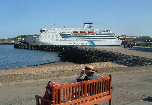


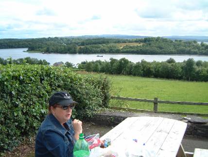


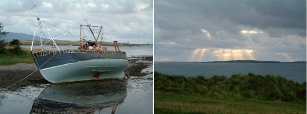


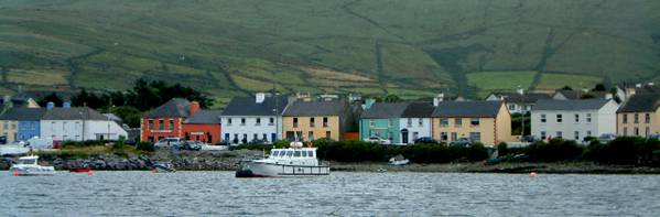


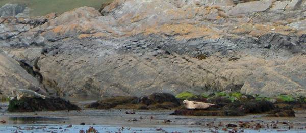


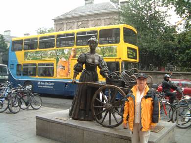


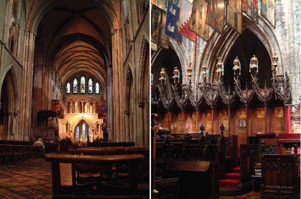


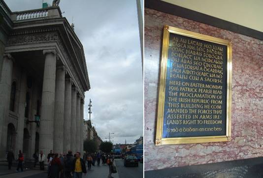


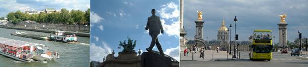


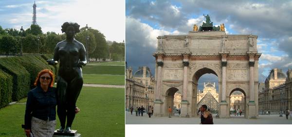


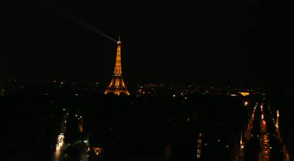


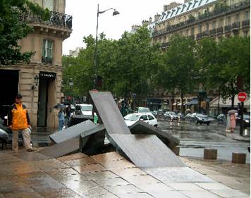


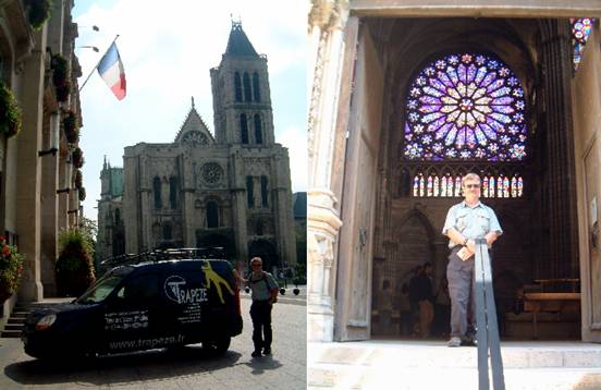


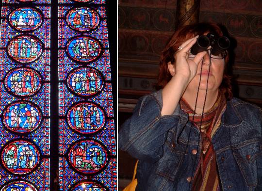
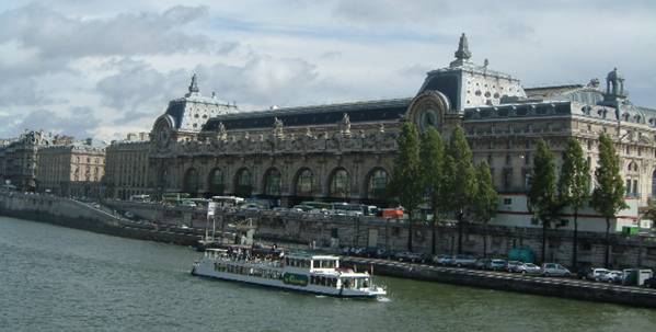


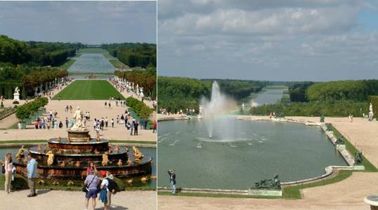


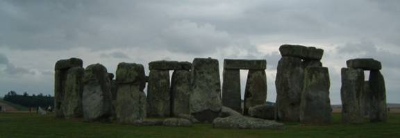


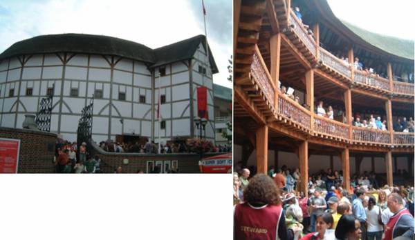


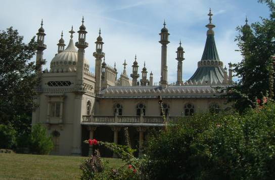


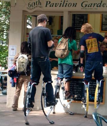
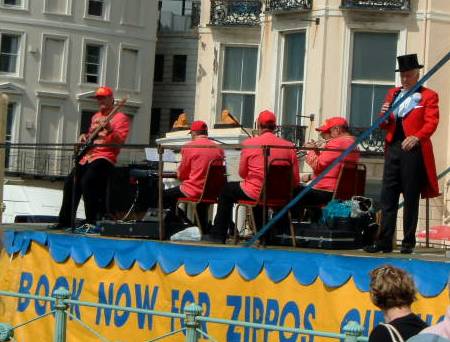


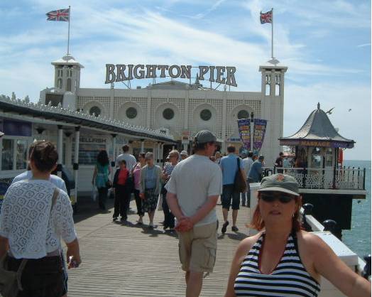
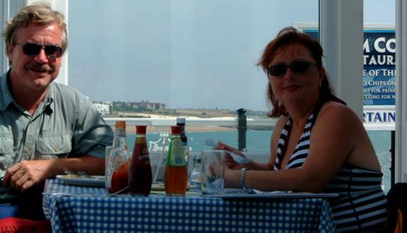


 Return to Main Menu